Brahaminical Hegemony has nothing to do with Calamity Management in the DMK ruled Anti Brahamin Aboriginal Humanscape and the Tsunami experience had no lesson to be learnt as Tamilnadu and Andhra are subjected to Natural Calamities time and again. It is only the Death Toll which counts!
Indian Holocaust My Father`s Life and Time - FIVE Hundred Thirty Five
Palash Biswas
http://indianholocaustmyfatherslifeandtime.blogspot.com/
http://basantipurtimes.blogspot.com/
It seems that the Brahaminical Hegemony has nothing to do with Calamity Management in the DMK ruled Anti Brahamin Aboriginal Humanscape and the Tsunami experience had no lesson to be learnt as Tamilnadu and Andhra are subjected to natural calamities time and again.
It is only the Death Toll which counts!
It is also raining in West Bengal coastal areas but it is welcome as it brings the most wanted Winter, always an enjoyable weather in Bengali lifestyle!
Heavy rains pounded Tamil Nadu for the second day today, throwing normal life out of gear and leading to closure of educational institutions in many districts.
Over 179 people have been killed in rain-related incidents across the state since the onset of the northeast monsoon in October, which is vigorous over Tamil Nadu and Puducherry.
As Mr Gopalan had warned taht it would be raining in Tamilnadu, we had Rain all over the state during our visit.In Andhra, specially in Vishakhapattanam it was too hot.
Even while we were returning from Bangaluru where it was cold and we were wearing sweaters and warm clothes but as soon as we reached in Vellore district it was Hot once again.
We knew the climate cycle and all about the late Monsoon.
It was Cyclone which hit the East Coast just before we had to reach Tamilnadu.
Now,a fresh low pressure trough in the Bay of Bengal is giving no respite to the rain battered Tamilnadu where a flood-like situation prevails in majority of the coastal districts.
All the reserviors in the state are full and there has been enormous damage to crops. Schools in eleven districts including Chennai, Cuddalore, Nagapattinam and Trichy will remain closed on Monday.Heavy rain is expected in again in many northern districts of Tamil Nadu.
Fishermen have been warned not to venture into the sea.
Meanwhile, the death toll in rain related incidents in Tamil Nadu has crossed one hundred and fifty.
A majority of deaths were due to electrocution, wall collapses, lightning and drowning in flood waters. More than 1,500 head of cattle have perished in the rains.
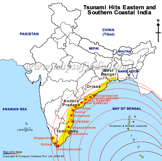
We have witnessed the signs of Tsunami still Fresh in Marina Beach, Chennai, though it did not touch RAMESHWARAM which further strenthened the Aryan superstitious Charisma of God Rama, the Killer!
I am sorruy that despite feeling the Refugee Influx from Srilanka in and around Ramnathpuram disrtict of Rameshwaram, I was unable to vist any Tamil Refugee camp.
As we did not know Tamil and were quite helpless to interact with the Rural Population which speaks only Tamil!
Now, LeT planned to set up base in TN, it is the latest story thanks to wikileaks!
Comparatively, the Cow belt is most inflicted with Terror and the Shaffron Terror is phennomenal there, but the Ruling Hegemony tend to brand Tamilnadu as a Terrorist state which is far better than any North Indian state as far as Law and Order is concerned. Sabita noted it minutely that women and children could travel with Heavy Jwellery everywhere in the South which we may never imagine in the North.
Tamilnadu is tagged with Maosit Hit Central India, North east and Kashmir, all of which makes the Aboriginal Humanscape.
The Antipathy against the Non Aryan Dravid people is quite evident despite the presence of south Indian Politicians and Officers in abundance in the centre.
It is the same case with the SC OBC bengali refugess who face Mass Destruction just because of the Brahamin ruling Bengal as well as India.
South Indian leadership has nothing to do with either the Tamil Refugees or the Rural Coastal pouplation Dravid Non Aryan!
The morning newspapers in Kolakta published stories about Maoist PREPAK nexus today.
Earlier they had been highlighting Litte Maoist link or ISI Maoist link as they fail to establish any link with China as china is least interested with the internal matters of India.
Had it been the case, it would have been very impossible to defend integrity and unity in the North East.
Though it was soothing experience for the eyes to see peasants busy in the Green fields harvesting paddy crop and at the same time planting the Paddy all over the South.
We could not stay in Khurda Road or Brahamapur to visit the Chilka Lake where our people the Scheduled caste Bengali Untouchable Refugees have been resettled.
In the Tanjavur district tribal region , as Waaman Meshram, the Bamcef chairperson told me, there is also a refugee Resettlement.It is also in the East Coast most cyclone prone.
I came to know about this only in Kanyakumari while Meshram and I interacted on mobile phone.
Later, Mangesh Kumar from OOTY also informed me that Persecuted Bengali Refugees are resettled somewhere in Nilgiri district but we could not locate them.
In Raichur district of Karnataka, near the kurnul ditrict of Andhra, more than 2200 hundred families of SC Bengali refugees are resettled and we remain disconnected to all these black untouchbales.
These people had been habitual of the climate conditions in the Bay of bengal region in their earst while homeland in East Bengal. But destiny ejected them and resettled in yet another cyclone prone zone!
We never know the casaulty inflicted upon them.
But the Non Aryan Dravid communities are NO diferent from these people, we have realised this time as Never before!
The rain fury has claimed as many as 179 lives in Tamil Nadu since the onset of northeast monsoon in late October. Chief Minister M. Karunanidhi Monday held an emergency meeting of officials to take stock of the situation.
According to the police control office here, the majority of deaths have taken place due to wall collapses and lightning strikes. The weather department has predicted rains till Tuesday evening in coastal districts due to low pressure in Bay of Bengal over Tamil Nadu.
In state capital Chennai, the incessant rains since Sunday night threw life out of gear.
Karunanidhi held a meeting with Chief Secretary S. Malathi and others to review the rain related damage and the relief measures being undertaken. The officials looked into the relief measures taken and checked whether the compensation amount has been properly distributed.
Meanwhile, eight senior officials continued their survey and estimation of rain damage in nine districts -- Cuddalore, Nagapattinam, Thanjavur, Thiruvarur, Villupuram, Tuticorin, Tirunelvelli, Pudukottai and Ramanathapuram.
The officials will submit their report Tuesday and the state cabinet will deliberate on that the same day.
The government has already announced Rs.100 crore towards relief operations in the first phase.
The weather office has predicted more rains during the next 24 hours beginning 0830 hrs today due to a well marked low pressure over the Bay of Bengal.
Chief Minister M Karunanidhi reviewed the situation with Chief Secretary S Malathi and Revenue officials.
"The well marked low pressure over Bay of Bengal is moving northwards. Under its influence heavy rains would continue to occur over coastal areas of Tamil Nadu and Puducherry during the next 24 hours starting today at 8.30 AM,", officials said.
They warned fishermen against venturing into the sea.
Strong onshore winds with speeds reaching 45-55 kmph are likely to blow along North Tamil Nadu and Puducherry coasts in the next 24 hours starting 0830 hrs today.
Thousands of acres of standing crops remained submerged across the state. Special officers appointed by the state government are on a tour of the rain-hit districts to assess the damage caused by the rain.
The officers would submit a report on the damage to crops and property, which will be discussed at an emergency meeting of the state Cabinet here tomorrow being chaired by Karunanidhi.
In Chennai, heavy rains since Sunday led to flooding of low-lying areas, making life difficult for office-goers, who had to wade through the water. Many trees were uprooted due to gusty winds.Corporation officials were working in full swing for rehabilitating people affected in the rain.
Traffic congestion was reported from different parts of the city especially in areas such as Guindy where preliminary works for the Metro rail project are underway.
Schools in Chennai and many other districts remained closed.
Educational institutions in neighbouring Puducherry also remained closed for the fifth successive day.
The state government had announced a sum of Rs 2 lakh to the kin of persons killed in rain-related incidents and allocated a sum of Rs 100 crore towards relief and repairs.
The water level in the Mettur dam in Salem this morning stood at 120.05 feet against the full level of 120 feet.
All the seven rivers running across different communes in Karaikal were in spate.
Kamayani Bali Mahabal posted in Say No to UID.
 * * |
Aadhar And UIDAI Are Tools Of Social Oppression Posted on December 2, 2010 < http://www.facebook.com/l/a12ce8y_nBB3t37yld39g_nTOlQ;cjnews.noads.biz/?p=847> by Catherine Fernandes < http://www.facebook.com/l/a12ceL2GNpVPyopxPBcVeDhUEIg;cjnews.noads.biz/?author=2> * * *Aadhar project of India* < http://www.facebook.com/l/a12ceE8jv9tbFYzVR8FxATJ3CJQ;perry4law.com/hr/uid.html> or UID project of India is often portrayed as a tool of social inclusion. But this is just a façade. The truth is that Aadhar is a tool and instrumentality of social oppression and social exploitation of Indians. To achieve this exploitative purpose, unique identification authority of India (UIDAI) has been established. Despite the ferocious protests by civil liberty activists, neither Aadhar project nor UIDAI are empowered by a legal framework. Even the National Identification Authority of India Bill 2010 (Bill) has failed to provide adequate safeguards against privacy violations and data breaches. Interestingly, even if the Bill proposed by UIDAI is made an enforceable law, it still remains unconstitutional. According to *Praveen Supreme Court Lawyer and leading Techno Legal Expert of India, even if the Bill becomes an enforceable piece of Legislation, it still is vulnerable to the attacks of "Unconstitutionality". In the absence of "Proper Laws and Adequate Safeguards", both Aadhar Project and UIDAI would remain "Unconstitutional", warns Praveen Dalal. The *privacy rights issues* < http://www.facebook.com/l/a12ceGXNiNmkEsekjbAJ7tBi9rA;cjnews.noads.biz/?p=834> are currently pending before the Supreme Court of India. It would be a good idea to strengthen Privacy and Data Protection Laws of India by "*Judicial Activism*< http://www.facebook.com/l/a12ceZgU8GawF5hqLofuWNL84iw;cjnews.noads.biz/?p=844>" in the absence of "Parliamentary Will", suggest Praveen Dalal. Behind the façade of social inclusion and welfare scheme, the naked face of Aadhar and UIDAI is very apparent. Aadhar project is an instrumentality of *e-surveillance in India* < http://www.facebook.com/l/a12cetWvx1GMzQPwrAooKj_8Fgg;cjnews.noads.biz/?p=824>. Its only purpose is to serve the unlawful interests of intelligence agencies of India and law enforcement demands in India. Let us not be fooled by the façade of social inclusion and welfare scheme and ask the government of India to enact suitable and adequate privacy and data protection laws before Aadhar is fully operational in India. http://www.facebook.com/l/a12cebJScAWqC0fzE-gqbL-eT7Q;cjnews.noads.biz/?p=847 |


1 |
Rs 745-crore plan for renovating dams in TN
Express News ServiceFirst Published : 21 Nov 2010 02:52:59 AM IST
Last Updated : 21 Nov 2010 09:50:16 AM IST
CHENNAI: Chief Minister M Karunanidhi on Saturday constituted an 11-member empowered committee headed by Chief Secretary S Malathi to expedite the Rs 745.49-crore plan drawn for renovating the dams in Tamil Nadu over a period of six years.The scheme will be implemented in a phased manner from next financial year. As many as 66 dams maintained by the Water Resources Department and 38 dams under the control of Tamil Nadu Electricity Board (TNEB) would be renovated under this scheme with an assistance from the World Bank.
Karunanidhi makes cryptic remark on Alagiri
"People are calling my son 'Anjanenjan Alagiri'. Just at the mention of the name Alagiri, some smile, others get angry and a few others feel hatred. But I think he is like a sugarcane. If one tastes the cane from the bottom, it tastes sweet. But if we go on tasting it up to its tip, one would taste sourness instead of sweetness."Similarly, the people of Tamil Nadu as well as DMK cadre in Madurai should use Alagiri the way they taste sugarcane.... If they go overboard and start using him to the tip thinking that he is just the son of Karunanidhi, it would be like tasting the tip of the sugarcane — it will tear their tongue.... My dear son Alagiri is a blend of all qualities," he said.The sugarcane metaphor assumes significance as there have been reports of simmering discontent in the mind of Alagiri, despite the bonhomie shared by various members of the Karunanidhi family at the wedding celebrations.Given the talk that Alagiri would mobilise support in the party after his son's wedding to push his case to lead the DMK, a question pops up: was Karunanidhi's suggestion that Alagiri has his limitations aimed at telling his supporters not to aspire for anything big for their leader?'Seeking resignation on CAG report unfair'
Express Buzz - Nov 11, 2010On Jayalalithaa's offer of support to the UPA government, Elangovan said "her offer has shown that she is desperate to come to power in Tamil Nadu and to ...
Video: A Raja takes a dig at Jayalalithaa

Congress in a bind over A Raja? Indian Express
DMK defiant: Why should Raja resign? Indian Express
all 227 news articles »
 Email this story
Moneycontrol.com
TN political scene set to change
Express Buzz - Nov 15, 2010Or, will the Congress be the prima donna? Whatever happens, the Raja episode is a harbinger to a change in political dynamics in Tamil Nadu.
Dial a scandal Indian Express
all 50 news articles »
 Email this story
SamayLive
TNUSRB Results 2010: TNUSRB publishes Police Constables Recruitment Result
Forestlaneshul - Nov 18, 2010The Tamilnadu Uniform Service Recruitment Board has declared the provisional result for the Combined Recruitment of Gr. II Police Constables, ...
TNUSRB Result: TNUSRB Police Constable (PC) Exam Results 2010 now online IndianTeller
TNUSRB Results 2010 of Recruitment Published News Downtown (blog)
all 10 news articles »
 Email this story
Tamilnadu Jai Bharath Mills to consider FCD issue on Dec 01, 2010
Equity Bulls - Nov 23, 2010Tamilnadu Jai Bharath Mills Ltd has announced that a meeting of the Board of Directors of the Company will be held on December 01, 2010, inter alia, ...
Infighting a democratic right: YC observer
Express Buzz - Nov 22, 2010WALAJABAD: Indian Youth Congress (IYC) general secretary in-charge of Tamil Nadu Priyavrat Singh condoned the factionalism within the Tamil Nadu Youth ...
Govt gives nod to setting up of 14 world-class universities
Economic Times - Nov 10, 2010... Coimbatore in Tamilnadu, Mysore in Karnataka, Pune in Maharashtra, Vishakhapatnam in Andhra Pradesh and Jaipur in Rajasthan respectively. ...
YC claim on government scheme irks DMK
Express Buzz - Nov 21, 2010Though the article indicates DMK's reluctance to hit out at its ally, it is clear that is gripped with fears over the growth of the Congress in Tamil Nadu.
TamilNadu Farmers face acute shortage of fertilizers
Humsafar News Site - Nov 15, 2010Tiruchirapalli, November, 14, 2010: President of the Tamil Nadu State unit of the AICC affiliated Kisan Khetmazdoor Congress, Pawankumar today said, ...

Super Good Movies
Upendra strikes back
Super Good Movies - 12 hours agoUpendra has got many fans in Andhra Pradesh and Tamilnadu and Super is sure going to rock them. Nayanthara played the female lead in this film while Tulip ...
Kerala spreading canards on dam's safety: MK
Express Buzz - Nov 13, 2010Referring to certain reports based on Kerala government's version, Karunanidhi said such reports went against the public interest in Tamil Nadu and did not ...
'Thoothukudi-Colombo ferry proposal soon'
Express Buzz - Nov 27, 2010All of these devotees now need to reach either Tiruchy or Chennai via air to go to Rameswaram and other parts of Tamil Nadu. Once the ferry service resumes, ...
UT's horticulture scene gets a fillip
Express Buzz - Nov 25, 2010Education trips to Tamil Nadu where local farmers took classes on horticulture form part of these programme. Now, after a few years of effort, Puducherry is ...
I'm the chosen one, says Preetika Rao
Daily News & Analysis - 10 hours agoShot in the southern regions of Tamilnadu — Karaikudi, Preetika recalls, "Our set was packed with children from the village. It was such a fun experience ...
NDTV.com
2G scam: MK defends Raja again
Express Buzz - 4 hours agoPTI CHENNAI: Backing former union telecom minister A Raja to the hilt, Tamil Nadu Chief Minister M Karunanidhitoday said he could not be termed as a culprit ...
'Can an individual swindle Rs 1.76 lakh crore?' Express Buzz
all 14 news articles »
 Email this story
Related sections for Tamilnadu
Paddy grown in 440 acre damage due to rains in Sirsi
SahilOnline - Dec 2, 2010So nearly 8-10 machines came from Tamilnadu are working in the paddy fields of Banavasi hobali. Agriculture Department Assistant Director Shivaprasad ...

Super Good Movies
Rakta Charitra is a flop!
Super Good Movies - Dec 4, 2010With Surya being the spearhead of the film, Ram Gopal Varma expected Ratha Charithiram to do well in Tamil as Suriya got a strong fan base in Tamilnadu. ...

The Hindu
Essar Hypermart targets 30% expansion of steel retail chain in TN by 2011
Machinist.in - Nov 16, 2010Chennai: Essar Hypermart plans to expand its retail outlets in Tamil Nadu by 30% from a total 44 outlets in Tamilnadu and Pondicherry to 58 by March 2011. ...
Essar Hypermart to expand its steel retail chain by 30% in Tamilnadu & Pondicherry Orissadiary.com
all 16 news articles »Email this story
Super Good Movies
Director locks lips with Heroine
Super Good Movies - Nov 17, 2010He has soon turned out to be a saleable hero in Tamilnadu, especially in rural areas. Sundar C knows the pulse of mass audience and never seizes to add all ...
12th Attempt Results Tamilnadu
Online PR News (press release) - Nov 9, 2010The Directorate of Government Examinations, Government of Tamil Nadu has announced the HSC (12th Class) Supplementary Results 2010. ...
Moneycontrol.com
After Adarsh Chavan, it's Licence Raja
Indian Express - Nov 14, 2010Spectrum Raja will resign, public memory being short, after a few months he will reappear as a minister in Tamilnadu. Our politicians are a shameless lot. ...
Video: I am an MP and always will be: Kanimozhi

Flustered Durai dashes back home Express Buzz
all 1,288 news articles »
 Email this story
Dr.Farooq Abdullah visits Suzlon's Wind-Farm at Radhapuram
India Infoline.com - Nov 25, 2010Dr.Farooq Abdullah, Union Minister for New and Renewable Energy along with Tamilnadu State Electricity Minister, Arcort Veeraswami today inaugurated the 2 ...
BOM:532667 - NSE:SUZLON

The Hindu
Private hospitals to start ICTC under PPP mode
The Hindu - Karthik Madhavan - Nov 24, 2010The target for Tamil Nadu is 200 ICTCs. Tamilnadu State AIDS Control Society (TANSACS), which will oversee the establishment of the centres, ...
Karunanidhi writes to PM
News Today - Nov 19, 2010Tamilnadu Chief Minister M Karunanidhi today appealed to Prime Minister Manmohan Singh to defer the draft Coastal Regulation Zone (CRZ) notification till ...
TN CM requests Centre to defer CRZ notification Express Buzz

LeT planned to set up base in TN: Wikileaks
Tamil Nadu was on the radar of the Lashkar-e-Toiba when it was planning to set up training sites and operational bases in southern India in the middle of 2009, according to US embassy cables released by WikiLeaks.
A June 18, 2009 document, titled 'US climate change negotiators targeted by cyber attack' and "derived from multiple sources", said Pakistan-based LeT member Shafiq Khafa was "possibly preparing for operations" and an LeT member based in India, Hussein, continued operational planning on three tasks, including a possible assassination of Gujarat Chief Minister Narendra Modi, in early June.
Khafa, who along with an India-based associate, SJ, prepared for operations in mid-June, was looking for information on possible training sites in Tamil Nadu, Karnataka and Kerala, revealed the document, uploaded by the Guardian newspaper's website.
The network of Khafa strove to put up two teams in the South, which would rely on the support of LeT members in India, Sri Lanka, Pakistan and Nepal, though specific details of planned attacks remained unknown.
Intelligence gathered in late- May, however, indicated Khafa's cell was engaged in surveillance activities of potential targets in southern India, stated the document.
Early May reports stated that Tamil Nadu and Kerala could be used as a base of operations following the establishment of a facilitation team in Sri Lanka.
The document added that the facilitation route and camps were estimated to be set up in two to three months.
The source for the document was marked 25X1-human and the reference to south India and Tamil Nadu is made under sub-head 'Key Concerns'.
Congress may capture power in TN: PC
. Speaking at a memorial meeting organised by K Selvaperunthagai besides others in the Tamil Nadu Congress Committee (TNCC) to mark the death anniversary of Babasaheb BR Ambedkar here, Chidambaram regretted that Dalits continued to face discrimination like untouchability even in urban areas.A way out of the situation was offered by education, he said and urged the oppressed people to use education and the support provided by the government as tools to overcome discrimination and succeed in life."Education would propel people to high positions in life besides providing the ability to solve tricky issues", he pointed out. The Congress-led UPA government had been implementing support schemes worth several thousands of crores to ensure that Dalits received good education. "Dalits are given incentives, financial assistance and reservation besides educational loans," he said and urged them to take this as a good opportunity and become qualified."Get good education. Please don't ignore it, because it is both a shield and weapon. Then, take positions in the party and then assume responsibilities in the government," he said. Stressing that the Congress party had always respected Dalits, Chidambaram pointed out that his party made Kakkanji the home minister in Tamil Nadu and Babu Jagjivan Ram the defence minister at the Centre.Expressing strong belief that the Congress party would get an opportunity to rule Tamil Nadu in future, he said: "At that point in time, when the Congress gets opportunity, a Dalit would be a home minister, a finance minister and a Dalit would even be the Chief Minister," he said.TMMK demands handing over of Babri Masjid site to Muslims
Submitted by admin3 on 6 December 2010 - 7:36pm
By TCN News,
Chennai: Tamilnadu Muslim Munnetra Kazhagam (TMMK) conducted sit-in at 42 important cities and towns of Tamilnadu today to remember the 18th anniversary of Babri Masjid demolition and express displeasure against the Allahabad High Court verdict of September 30.
At the dharnas, TMMK demanded prosecution of 68 persons accused by the Liberhan Commission as responsible for Babri Masjid demolition, expedition of the Babri Masjid criminal case pending in the Raebareli and speedy disposal of the appeal petition filed against the judgement given by the Allahabad High Court in the Babri Masjid title suit.
Prof. M.H. Jawahirullah, President, TMMK, led a dharna in which political activists Mr. Jagaveerapandian, Mr. Che. Ku. Tamilarasan, Advocate Muthukrishnan, CPM State Executive committee Member Mr. Shanmugam, besides others participated to express their solidarity.
Speaking on the occasion Prof. M.H. Jawahirullah said all illegal activities relating to Babri Masjid have happened when Congress was ruling the country. He said prayers were held in Babri Masjid from 1528 to 1949 December 22. On the night of December 22 idols were placed under the central dome of the Masjid when Congress was ruling the centre and the state of UP. Similarly on February 1, 1985, when Congress was ruling the country and the UP state the locks of Babri Masjid were ordered to be opened by the Faizabad District court which has no jurisdiction to pass such an order. The court order came a few days after the then Prime Minister Mr. Rajiv Gandhi has promised that the locks of Babri Masjid would be opened to allow Darshan before Shivaratri. Babri Masjid was demolished on 6th December 1992 when the P.V. Narasimsha Rao led Congress Government was in power at the centre. The then Congress Prime Minister had promised the nation in
his televised speech that the Masjid would be reconstructed at the spot where it stood. Successive Congress Governments have failed to keep up this promise.
"To add salt to the wound, the Lucknow Bench of the Allahabad High Court has given a judgement which is a black dot in the history of Indian Judiciary when Congress is again ruling the nation. The Congress party should remember that it lost power in UP and
subsequently in Delhi for its anti secular and anti constitutional misdemeanours in the Babri Masjid case," TMMK chief said.
http://twocircles.net/2010dec06/tmmk_demands_handing_over_babri_masjid_site_muslims.html
Rahul's mission TN to take off with YC yatra
CHENNAI: Youth Congress activists will tour the length and breadth of State's hinterland in the next four months to unleash an information blitzkrieg on the achievements of the Union government as part of the 'Mission Tamil Nadu' launched by Rahul Gandhi.The State executive committee of the TN Youth Congress met at Delhi on Thursday and several plans to help galvanise the party in the State through the youth wing ahead of the 2011 polls were finalised by Rahul Gandhi.Speaking to Express, State Youth Congress president M Yuvaraja said Rahul Gandhi was determined to see the party rise in the State. Rahul unveiled a plan, "Mission Tamil Nadu," which aimed at strengthening the party at the grassroot level.As part of the plan, youth wing workers would tour rural regions to publicise the Centre's schemes. The rural padyatra will commence on December 28 and conclude on January 26. This will be the first step of the mission to be followed by streetcorner and public meetingsFor the next four months, programmes have been finalised that had a twin objective of understanding the commonman's problems better and to sensitise them to the measures taken by the Centre."Rahul appreciated our recent padyatra campaign. He stressed the need to do more especially in rural areas," Yuvaraja said adding this was the first time Rahul that participated in the executive meet of a State youth unit. Mission Tamil Nadu is part of a comprehensive plan to help brighten the party prospects which is not only aimed at the legislative assembly elections.
http://expressbuzz.com/states/tamilnadu/rahuls-mission-tn-to-take-off-with-yc-yatra/227920.html
Tapes talk volumes about MK's family: Jaya
CHENNAI: The telephonic conversations corporate lobbyist Niira Radia had with former Union telecom minister A Raja, some industrialists and journalists "mainly show the first family of Tamil Nadu in their true colours," AIADMK general secretary J Jayalalithaa charged on Friday.In a statement, Jayalalithaa said: "In the brouhaha over the Rs1,76,379 crore 2-G spectrum scam perpetrated by A Raja of the DMK, an interesting side-show has gone largely unnoticed, at least in Tamil Nadu: the series of telephonic conversations between the various dramatis personae with Niira Radia, a liaison agent for large corporates like the Tatas and Ambanis, who is also a political wheeler-dealer, apparently wielding considerable extra-constitutional influence in the corridors of power." "A conversation between Niira Radia and senior journalist Vir Sanghvi (who was apparently an interlocutor between the Karunanidhi family and the Congress leadership), shows the utter disdain the Central leadership has for its Tamil Nadu allies."An excerpt from the tapes shows Sanghvi as saying: "As far as we are concerned, there are two wives, one brother, one sister, one nephew… It's all got very complicated for us… This is not a Congress-DMK problem. This is an internal DMK problem because they can't get their act together between all his wives and children and nephews…"Jayalalithaa said Karunanidhi's daughter Kanimozhi is on record demanding for herself the Environment portfolio, failing which she wants Health or Aviation or Tourism and Culture. Kanimozhi is also on record making an impassioned plea for the telecom portfolio for her close friend, A Raja, while foul-mouthing another aspirant, her nephew and Karunanidhi's grand-nephew Dayanidhi Maran."Another senior journalist Barkha Dutt is recorded conveying the Congress leadership's exasperation over a media announcement by T R Baalu that the DMK was planning to boycott the swearing-in ceremony to embarrass the Congress and pressure them to yield to the DMK's multifarious demands," she pointed out in the statement.One conversation reveals that Dayanidhi Maran had been carrying out a smear campaign in Delhi circles against his uncle and Karunanidhi's elder son M K Alagiri, whom Dayanidhi had described as uneducated, having studied only up to Class V and illiterate in English. Yet another conversation indicates that Dayanidhi was canvassing for a "lucrative" infrastructure portfolio for himself, against the wishes of the DMK chief."A person like Alagiri, whom the Tamil Nadu population know as one accused in murder cases, and whose close circle of friends include 'Attack' Pandi, 'Sori' Murugan, 'Auto' Ravi, 'Ochu' Balu and 'Blade' Pakiri, has been projected to the Central leadership as a 'mass leader'.""In yet another conversation between Niira Radia and Vir Sanghvi, it comes out that despite Karunanidhi's objections to Dayanidhi Maran, the Maran scion's candidature was being actively canvassed by M K Stalin and M K Selvi, who is married to Murasoli Maran's brother Selvam."The reason for pushing Dayanidhi does not apparently stem from blood ties, but "from the fact that Dayanidhi had paid a whopping Rs 600 crore to Stalin and Selvi's mother and one of Karunanidhi's wives, Dayalu." This is in addition to the "rounded up" sum paid by Kalanidhi Maran to the Karunanidhis for relinquishing their shares in the Sun TV network in 2007, the AIADMK leader said.She said the period of the recordings leaked in the media relate to the days of ministry formation of UPA-2, when Karunanidhi was bargaining hard to get the maximum number of plum portfolios with money-earning potential, not for the DMK members, but for the various members of his own huge family."The IT Department was trying to trace the trail of the illegal funds of political persons obtained through extending favours to corporate houses and for this purpose had placed the telephones and mobile phones of Niira Radia under surveillance for a certain period," Jayalalithaa said.
Ahead of Pongal, actor Vijay may float new party
.At the closed-door meeting of the office-bearers of his fan club held at V S Kalayana Mandapam in Vadapalani, the actor reportedly sought the views of his fans on his entering politics. They overwhelmingly supported the idea of a new party and entering the electoral arena solo rather than his joining some other party. However, some fans suggested that the new party could forge an alliance with the AIADMK.Deliberations were on inside the mandapam with the media kept at bay since noon. Around 7.30 pm, when the fans dispersed, they were confident that a new party would be launched.It is said that Vijay had been speaking his mind to fans at the district level for quite some time, though this was the first time he had called fan club leaders from all over the State for a meeting. However, it remains to be seen if the new party would make any impact in State politics, for Vijay's following is more or less restricted to his fan clubs. He also has a string of box office failures and had political ambitions.Over a year ago, he even went to New Delhi to meet AICC general secretary Rahul Gandhi. Though nothing came of the meeting — it was then said that he wanted to be the chief of the Tamil Nadu Congress unit — and he continued to act in films, it now appears that he has dropped the Congress option.Be that as it may, with a whole host of political parties in the scene, Vijay might not be able to make a mark as a leader.It is also doubtful whether people would accept him as a politician at a time when he is also not seen as a successful actor.Tsunami Of 2004
Search for Tsunami Of 2004 Find Tsunami Of 2004Ask.com
Search Results
Images for tsunami 2004
- Report images


Videos for tsunami 2004


2004 Boxing Day Tsunami
6 min - 18 Mar 2008
Uploaded by 747TakeMeAway747
youtube.com
Tsunami 2004
4 min - 11 Apr 2009
metacafe.com2004 Indian Ocean earthquake and tsunami - Wikipedia, the free ...
The 2004 Indian Ocean earthquake was an undersea megathrust earthquake that occurred at 00:58:53 UTC on December 26, 2004, with an epicentre off the west ...
en.wikipedia.org/wiki/2004_Indian_Ocean_earthquake_and_tsunami - CachedTsunami - Wikipedia, the free encyclopedia
In the 2004 Indian Ocean tsunami drawback was not reported on the African ...
en.wikipedia.org/wiki/Tsunami - Cached - SimilarINDIAN OCEAN TSUNAMI - Great Earthquake and Tsunami of 26 December ...
The epicenter of the 26 December 2004 earthquake was near the triple point junction of three tectonic plates where major earthquakes and tsunamis have ...
www.drgeorgepc.com/Tsunami2004Indonesia.html - Cached - SimilarThe Deadliest Tsunami in History?
7 Jan 2005 ... The earthquake that generated the great Indian Ocean tsunami of 2004 is estimated to have released the energy of 23000 Hiroshima-type atomic ...
news.nationalgeographic.com/.../2004/.../1227_041226_tsunami.html - Cached - Similar- [PDF]
Effects of the December 2004 Indian Ocean Tsunami on the Indian ...
File Format: PDF/Adobe Acrobat - View as HTML
by A Sheth - 2006 - Cited by 4 - Related articles
The 26 December 2004 tsunami significantly affected the coastal regions ... Prior to 26 December 2004, there was no known record of tsunamis on the ...
www.iitk.ac.in/nicee/RP/2006_Effect_EQSpectra.pdf - Similar Tsunami 2004
3 Dec 2010 ... In this, Nalaka recalls his impressions of the mainstream medias coverage of the Asian Tsunami of December 2004, and explains why his ...
tsunami2004.org/ - CachedTsunami Videos - Amateur Tsunami Video Footage
Video Description: Amateur camcorder footage of the 2004 tsunami disaster shot from the balcony of a motel. The cameraman (father) is with his wife and son ...
www.asiantsunamivideos.com/ - Cached - SimilarTsunami India, Tsunami Affected Areas in India 2004
Tsunami India, Tsunami Affected Areas in India, Tsunami Hit India Asia, Tsunami India 2004, Tsunami Hit Areas in India, Tidal Waves Hit India, ...
www.mapsofindia.com › Maps - Cached - Similar


Ads
|
Tsunami Affected Area in India |
| |
| ||||||||
| ||||||||
 | ||||||||
|
2004 Indian Ocean earthquake and tsunami
 | |||||||
| Tsunami strikes Ao Nang, Thailand. | |||||||
| Date | December 26, 2004 | ||||||
|---|---|---|---|---|---|---|---|
| Magnitude | 9.1 Mw | ||||||
| Depth | 30 km (19 mi) | ||||||
| Epicenter location | 3°18′58″N 95°51′14″E / 3.316°N 95.854°ECoordinates: 3°18′58″N 95°51′14″E / 3.316°N 95.854°E | ||||||
| Type | Undersea (subduction) | ||||||
| Countries or regions affected | Indonesia (mainly in Aceh) Sri Lanka India (mostly in Tamil Nadu) Thailand Maldives | ||||||
| Tsunami | Yes | ||||||
| Casualties | 230,000+[1][2] (the fifth deadliest earthquake in recorded history)
| ||||||


The 2004 Indian Ocean earthquake was an undersea megathrust earthquake that occurred at 00:58:53 UTC on December 26, 2004, with an epicentre off the west coast of Sumatra, Indonesia. The quake itself is known by the scientific community as the Sumatra-Andaman earthquake.[3][4] The resulting tsunami is given various names, including the 2004 Indian Ocean tsunami, Asian Tsunami, Indonesian Tsunami, and Boxing Day Tsunami.
The earthquake was caused by subduction and triggered a series of devastating tsunamis along the coasts of most landmasses bordering the Indian Ocean, killing over 230,000 people in fourteen countries, and inundating coastal communities with waves up to 30 meters (100 feet) high.[5] It was one of the deadliest natural disasters in recorded history. Indonesia was the hardest hit, followed by Sri Lanka, India, and Thailand.
With a magnitude of between 9.1 and 9.3, it is the third largest earthquake ever recorded on a seismograph. This earthquake had the longest duration of faulting ever observed, between 8.3 and 10 minutes. It caused the entire planet to vibrate as much as 1 cm (0.4 inches)[6] and triggered other earthquakes as far away as Alaska.[7] Its hypocenter was between Simeulue and mainland Indonesia.[8]
The plight of the many affected people and countries prompted a worldwide humanitarian response. In all, the worldwide community donated more than $14 billion (2004 U.S. dollars) in humanitarian aid.[9]
Contents[hide] |
Earthquake characteristics
The earthquake was initially reported as moment magnitude 9.0. In February 2005 scientists revised the estimate of the magnitude to 9.3.[10] Although the Pacific Tsunami Warning Center has accepted these new numbers, the United States Geological Survey has so far not changed its estimate of 9.1. The most recent studies in 2006 have obtained a magnitude of Mw 9.1–9.3. Dr. Hiroo Kanamori of the California Institute of Technology believes that Mw 9.2 is a good representative value for the size of this great earthquake.[11]
The hypocentre of the main earthquake was approximately 160 km (100 mi), in the Indian Ocean just north of Simeulue island, off the western coast of northern Sumatra, at a depth of 30 km (19 mi) below mean sea level (initially reported as 10 km). The northern section of the Sunda megathrust, which had been assumed dormant, ruptured; the rupture having a length of 1300 km.[8] The size of the rupture caused plate shifting of up to 20 m,[citation needed] causing the earthquake (followed by the tsunami) to be felt simultaneously as far away as Bangladesh, India, Malaysia, Myanmar, Thailand, Singapore and the Maldives.[12] Splay faults, or secondary "pop up faults", caused long, narrow parts of the sea floor to pop up in seconds. This quickly elevated the height and increased the speed of waves, causing the complete destruction of the nearby Indonesian town of Lhoknga. [13]

Indonesia lies between the Pacific Ring of Fire along the north-eastern islands adjacent to and including New Guinea and the Alpide belt along the south and west from Sumatra, Java, Bali, Flores, and Timor.
Great earthquakes such as the Sumatra-Andaman event, which are invariably associated with megathrust events in subduction zones, have seismic moments that can account for a significant fraction of the global earthquake moment across century-scale time periods. The Sumatra-Andaman earthquake was the largest earthquake since 1964, and the second largest since the Kamchatka earthquake of October 16, 1737.
Of all the seismic moment released by earthquakes in the 100 years from 1906 through 2005, roughly one-eighth was due to the Sumatra-Andaman event. This quake, together with the Good Friday Earthquake (Alaska, 1964) and the Great Chilean Earthquake (1960), account for almost half of the total moment. The much smaller but still catastrophic 1906 San Francisco earthquake is included in the diagram below for perspective. Mw denotes the magnitude of an earthquake on the moment magnitude scale.
Since 1900 the only earthquakes recorded with a greater magnitude were the 1960 Great Chilean Earthquake (magnitude 9.5) and the 1964 Good Friday Earthquake in Prince William Sound (9.2). The only other recorded earthquake of magnitude 9.0 or greater was off Kamchatka, Russia, on November 4, 1952 (magnitude 9.0).[14] Each of these megathrust earthquakes also spawned tsunamis in the Pacific Ocean, but the death toll from these was significantly lower. The worst of these caused only a few thousand deaths, primarily because of the lower population density along the coasts near affected areas and the much greater distances to more populated coasts.
Other very large megathrust earthquakes occurred in 1868 (Peru, Nazca Plate and South American Plate); 1827 (Colombia, Nazca Plate and South American Plate); 1812 (Venezuela, Caribbean Plate and South American Plate) and 1700 (western North America, Juan de Fuca Plate and North American Plate). All of them are believed to be greater than magnitude 9, but no accurate measurements were available at the time.
Tectonic plates

The megathrust earthquake was unusually large in geographical and geological extent. An estimated 1,600 km (994 mi) of fault surface slipped (or ruptured) about 15 m (50 ft) along the subduction zone where the India Plate slides (or subducts) under the overriding Burma Plate. The slip did not happen instantaneously but took place in two phases over a period of several minutes:
- Seismographic and acoustic data indicate that the first phase involved a rupture about 400 km (250 mi) long and 100 km (60 mi) wide, located 30 km (19 mi) beneath the sea bed—the largest rupture ever known to have been caused by an earthquake. The rupture proceeded at a speed of about 2.8 km/s (1.7 mi/s) or 10,000 km/h (6,300 mph), beginning off the coast of Aceh and proceeding north-westerly over a period of about 100 seconds.
- A pause of about another 100 seconds took place before the rupture continued northwards towards the Andaman and Nicobar Islands. However, the northern rupture occurred more slowly than in the south, at about 2.1 km/s (1.3 mi/s) or 7,600 km/h (4,700 mph), continuing north for another five minutes to a plate boundary where the fault type changes from subduction to strike-slip (the two plates slide past one another in opposite directions). This reduced the speed of the water displacement and so reducing the size of the tsunami that hit the northern part of the Indian Ocean.[15]
The India Plate is part of the great Indo-Australian Plate, which underlies the Indian Ocean and Bay of Bengal, and is drifting north-east at an average of 6 cm/year (2 inches per year). The India Plate meets the Burma Plate (which is considered a portion of the great Eurasian Plate) at the Sunda Trench. At this point the India Plate subducts beneath the Burma Plate, which carries the Nicobar Islands, the Andaman Islands, and northern Sumatra. The India Plate sinks deeper and deeper beneath the Burma Plate until the increasing temperature and pressure drive volatiles out of the subducting plate. These volatiles rise into the overlying plate causing partial melting and the formation of magma. The rising magma intrudes into the crust above and exits the Earth's crust through volcanoes in the form of a volcanic arc. The volcanic activity that results as the Indo-Australian Plate subducts the Eurasian Plate has created the Sunda Arc.
As well as the sideways movement between the plates, the sea floor is estimated to have risen by several metres, displacing an estimated 30 km3 (7 cu mi) of water and triggering devastating tsunami waves. The waves did not originate from a point source, as was inaccurately depicted in some illustrations of their paths of travel, but rather radiated outwards along the entire 1,600 km (994 mi) length of the rupture (acting as a line source). This greatly increased the geographical area over which the waves were observed, reaching as far as Mexico, Chile, and the Arctic. The raising of the sea floor significantly reduced the capacity of the Indian Ocean, producing a permanent rise in the global sea level by an estimated 0.1 mm (0.01 cm or 0.0001 m).[16]
Aftershocks and other earthquakes

Numerous aftershocks were reported off the Andaman Islands, the Nicobar Islands and the region of the original epicentre in the hours and days that followed. The largest aftershock, which originated off the coast of the Sumatran island of Nias, registered a magnitude of 8.7,[17] prompting debate among seismologists as to whether it should be classified as an aftershock of the December 2004 quake or as a "triggered earthquake" (which typically differs from an aftershock in that it is not located along the same fault line and may be as large or larger than the earthquake which triggered it).[18] This earthquake was so large that it produced its own aftershocks (some registering a magnitude of as great as 6.1) and presently ranks as the 7th largest earthquake on record since 1900. Other aftershocks of up to magnitude 6.6 continued to shake the region daily for up to three or four months.[19][20] As well as continuing aftershocks, the energy released by the original earthquake continued to make its presence felt well after the event. A week after the earthquake, its reverberations could still be measured, providing valuable scientific data about the Earth's interior.
The 2004 Indian Ocean earthquake came just three days after a magnitude 8.1 earthquake in an uninhabited region west of New Zealand's sub-Antarctic Auckland Islands, and north of Australia's Macquarie Island. This is unusual, since earthquakes of magnitude 8 or more occur only about once per year on average.[21] Some seismologists have speculated about a connection between these two earthquakes, saying that the former one might have been a catalyst to the Indian Ocean earthquake, as the two earthquakes happened on opposite sides of the Indo-Australian Plate. However, the U.S. Geological Survey sees no evidence of a causal relationship in this incident. Coincidentally, the earthquake struck almost exactly one year (to the hour) after a 6.6 magnitude earthquake killed an estimated 30,000 people in the city of Bam in Iran on December 26, 2003.[22]
Some scientists confirm that the December earthquake had activated Leuser Mountain, a volcano in Aceh province along the same range of peaks as Mount Talang, while the 2005 Sumatran earthquake had sparked activity in Lake Toba, an ancient crater in Sumatra.[23] Geologists say that the eruption of Mount Talang in April 2005 is connected to the December earthquake.[24]
Energy released
The energy released on the Earth's surface only (ME, which is the seismic potential for damage) by the 2004 Indian Ocean earthquake and tsunami was estimated at 1.1×10¹⁷ joules,[25] or 26.3 megatons of TNT. This energy is equivalent to over 1502 times that of the Hiroshima atomic bomb, but less than that of Tsar Bomba, the largest nuclear weapon ever detonated. However, this is but a tiny fraction of the total work done MW (and thus energy) by this quake, 4.0×10²² joules (4.0×1029 ergs),[26] the vast majority underground. This equates to 4.0×10²² J, over 363,000 times more than its ME. This is a truly enormous figure, equivalent to 9,560 gigatons of TNT equivalent (550 million times that of Hiroshima), or about 370 years of energy use in the United States at 2005 levels of 1.08×10²⁰ J.
The only recorded earthquakes with a larger MW were the 1960 Chilean and 1964 Alaskan quakes, with 2.5×10²³ joules (250 ZJ) and 7.5×10²² joules (75 ZJ) respectively.[27]
The earthquake generated a seismic oscillation of the Earth's surface of up to 20–30 cm (8–12 in), equivalent to the effect of the tidal forces caused by the Sun and Moon. The shock waves of the earthquake were felt across the planet; as far away as the U.S. state of Oklahoma, where vertical movements of 3 mm (0.12 in) were recorded. By February 2005, the earthquake's effects were still detectable as a 0.02 mm complex harmonic oscillation of the Earth's surface, which gradually diminished and merged with the incessant free oscillation of the Earth more than 4 months after the earthquake.[28]
Because of its enormous energy release and shallow rupture depth, the earthquake generated remarkable seismic ground motions around the globe, particularly due to huge Rayleigh (surface) elastic waves that exceeded 1 cm in vertical amplitude everywhere on Earth. The record section plot below displays vertical displacements of the Earth's surface recorded by seismometers from the IRIS/USGS Global Seismographic Network plotted with respect to time (since the earthquake initiation) on the horizontal axis, and vertical displacements of the Earth on the vertical axis (note the 1 cm scale bar at the bottom for scale). The seismograms are arranged vertically by distance from the epicenter in degrees. The earliest, lower amplitude, signal is that of the compressional (P) wave, which takes about 22 minutes to reach the other side of the planet (the antipode; in this case near Ecuador). The largest amplitude signals are seismic surface waves that reach the antipode after about 100 minutes. The surface waves can be clearly seen to reinforce near the antipode (with the closest seismic stations in Ecuador), and to subsequently encircle the planet to return to the epicentral region after about 200 minutes. A major aftershock (magnitude 7.1) can be seen at the closest stations starting just after the 200 minute mark. This aftershock would be considered a major earthquake under ordinary circumstances, but is dwarfed by the mainshock.

The shift of mass and the massive release of energy very slightly altered the Earth's rotation. The exact amount is not yet known, but theoretical models suggest the earthquake shortened the length of a day by 2.68 microseconds, due to a decrease in the oblateness of the Earth.[29] It also caused the Earth to minutely "wobble" on its axis by up to 2.5 cm (1 in) in the direction of 145° east longitude,[30] or perhaps by up to 5 or 6 cm (2.0 to 2.4 in).[31] However, because of tidal effects of the Moon, the length of a day increases at an average of 15 µs per year, so any rotational change due to the earthquake will be lost quickly. Similarly, the natural Chandler wobble of the Earth, which in some cases can be up to 15 m (50 ft), will eventually offset the minor wobble produced by the earthquake.
More spectacularly, there was 10 m (33 ft) movement laterally and 4–5 m (13–16 ft) vertically along the fault line. Early speculation was that some of the smaller islands south-west of Sumatra, which is on the Burma Plate (the southern regions are on the Sunda Plate), might have moved south-west by up to 36 m (118 ft), but more accurate data released more than a month after the earthquake found the movement to be about 20 cm (7.9 in).[32] Since movement was vertical as well as lateral, some coastal areas may have been moved to below sea level. The Andaman and Nicobar Islands appear to have shifted south-west by around 1.25 m (4.1 ft) and to have sunk by 1 m (3.28 ft).[33]
In February 2005, the Royal Navy vessel HMS Scott surveyed the seabed around the earthquake zone, which varies in depth between 1,000 m and 5,000 m (3,300 ft and 16,500 ft). The survey, conducted using a high-resolution, multi-beam sonar system, revealed that the earthquake had made a huge impact on the topography of the seabed. 1,500-meter (5,000 ft) high thrust ridges created by previous geologic activity along the fault had collapsed, generating landslides several kilometers wide. One such landslide consisted of a single block of rock some 100 m high and 2 km long (300 ft by 1.25 mi). The momentum of the water displaced by tectonic uplift had also dragged massive slabs of rock, each weighing millions of tons, as far as 10 km (7 mi) across the seabed. An oceanic trench several kilometres wide was exposed in the earthquake zone.[34]
The TOPEX/Poseidon and Jason 1 satellites happened to pass over the tsunami as it was crossing the ocean.[35] These satellites carry radars that measure precisely the height of the water surface; anomalies of the order of 50 cm (20 in) were measured. Measurements from these satellites may prove invaluable for the understanding of the earthquake and tsunami.[36] Unlike data from tide gauges installed on shores, measurements obtained in the middle of the ocean can be used for computing the parameters of the source earthquake without having to compensate for the complex ways in which close proximity to the coast changes the size and shape of a wave.
Tsunami characteristics

The sudden vertical rise of the seabed by several metres during the earthquake displaced massive volumes of water, resulting in a tsunami that struck the coasts of the Indian Ocean. A tsunami which causes damage far away from its source is sometimes called a teletsunami and is much more likely to be produced by vertical motion of the seabed than by horizontal motion.[37]
The tsunami, like all others, behaved very differently in deep water than in shallow water. In deep ocean water, tsunami waves form only a small hump, barely noticeable and harmless, which generally travels at a very high speed of 500 to 1,000 km/h (310 to 620 mph); in shallow water near coastlines, a tsunami slows down to only tens of kilometres an hour, but in doing so forms large destructive waves. Scientists investigating the damage in Aceh found evidence that the wave reached a height of 24 m (79 ft) when coming ashore along large stretches of the coastline, rising to 30 m (98 ft) in some areas when travelling inland.[5]
Radar satellites recorded the heights of tsunami waves in deep water: at two hours after the earthquake, the maximum height was 60 centimetres (2.0 ft). These are the first such observations ever made. Unfortunately these observations could not be used to provide a warning, since the satellites were not built for that purpose and the data took hours to analyze.[38][39]
According to Tad Murty, vice-president of the Tsunami Society, the total energy of the tsunami waves was equivalent to about five megatons of TNT (20 petajoules). This is more than twice the total explosive energy used during all of World War II (including the two atomic bombs), but still a couple of orders of magnitude less than the energy released in the earthquake itself. In many places the waves reached as far as 2 km (1 mi) inland.[40]

Because the 1,600 km (994 mi) fault affected by the earthquake was in a nearly north-south orientation, the greatest strength of the tsunami waves was in an east-west direction. Bangladesh, which lies at the northern end of the Bay of Bengal, had very few casualties despite being a low-lying country relatively near the epicenter. It also benefited from the fact that the earthquake proceeded more slowly in the northern rupture zone, greatly reducing the energy of the water displacements in that region.
Coasts that have a landmass between them and the tsunami's location of origin are usually safe; however, tsunami waves can sometimes diffract around such landmasses. Thus, the Indian state of Kerala was hit by the tsunami despite being on the western coast of India, and the western coast of Sri Lanka also suffered substantial impacts. Also distance alone was no guarantee of safety; Somalia was hit harder than Bangladesh despite being much farther away.
Because of the distances involved, the tsunami took anywhere from fifteen minutes to seven hours (for Somalia) to reach the various coastlines.[41][42] The northern regions of the Indonesian island of Sumatra were hit very quickly, while Sri Lanka and the east coast of India were hit roughly 90 minutes to two hours later. Thailand was also struck about two hours later despite being closer to the epicentre, because the tsunami travelled more slowly in the shallow Andaman Sea off its western coast.
The tsunami was noticed as far as Struisbaai in South Africa, some 8,500 km (5,282 mi) away, where a 1.5 m (5 ft) high tide surged on shore about 16 hours after the earthquake. It took a relatively long time to reach this spot at the southernmost point of Africa, probably because of the broad continental shelf off South Africa and because the tsunami would have followed the South African coast from east to west. The tsunami also reached Antarctica, where tidal gauges at Japan's Showa Base recorded oscillations of up to a metre, with disturbances lasting a couple of days.[43]
Some of the tsunami's energy escaped into the Pacific Ocean, where it produced small but measurable tsunamis along the western coasts of North and South America, typically around 20 to 40 cm (7.9 to 15.7 in).[44] At Manzanillo, Mexico, a 2.6 m (8.5 ft) crest-to-trough tsunami was measured. As well, the tsunami was large enough to be detected in Vancouver, British Columbia, Canada. This puzzled many scientists, as the tsunamis measured in some parts of South America were larger than those measured in some parts of the Indian Ocean. It has been theorized that the tsunamis were focused and directed at long ranges by the mid-ocean ridges which run along the margins of the continental plates.[45]
Signs and warnings

Despite a lag of up to several hours between the earthquake and the impact of the tsunami, nearly all of the victims were taken completely by surprise. There were no tsunami warning systems in the Indian Ocean to detect tsunamis or to warn the general populace living around the ocean. Tsunami detection is not easy because while a tsunami is in deep water it has little height and a network of sensors is needed to detect it. Setting up the communications infrastructure to issue timely warnings is an even bigger problem, particularly in a relatively poor part of the world.
Tsunami are much more frequent in the Pacific Ocean because of earthquakes in the "Ring of Fire", and an effective tsunami warning system has long been in place there. Although the extreme western edge of the Ring of Fire extends into the Indian Ocean (the point where this earthquake struck), no warning system exists in that ocean. Tsunamis there are relatively rare despite earthquakes being relatively frequent in Indonesia. The last major tsunami was caused by the Krakatoa eruption of 1883. It should be noted that not every earthquake produces large tsunamis; on March 28, 2005, a magnitude 8.7 earthquake hit roughly the same area of the Indian Ocean but did not result in a major tsunami.
In the aftermath of the disaster, there is now an awareness of the need for a tsunami warning system for the Indian Ocean. The United Nations started working on an Indian Ocean Tsunami Warning System and by 2005 had the initial steps in place. Some have even proposed creating a unified global tsunami warning system, to include the Atlantic Ocean and Caribbean.
The first warning sign of a possible tsunami is the earthquake itself. However, tsunami can strike thousands of kilometres away where the earthquake is only felt weakly or not at all. Also, in the minutes preceding a tsunami strike, the sea often recedes temporarily from the coast. Around the Indian Ocean, this rare sight reportedly induced people, especially children, to visit the coast to investigate and collect stranded fish on as much as 2.5 km (1.6 mi) of exposed beach, with fatal results.[46] However, not all tsunami causes this "disappearing sea" effect. In some cases, there are no warning signs at all: the sea will suddenly swell without retreating, surprising many people and giving them little time to flee.
One of the few coastal areas to evacuate ahead of the tsunami was on the Indonesian island of Simeulue, very close to the epicentre. Island folklore recounted an earthquake and tsunami in 1907, and the islanders fled to inland hills after the initial shaking yet before the tsunami struck.[47] On Maikhao beach in northern Phuket, Thailand, a 10-year-old British tourist named Tilly Smith had studied tsunami in geography class at school and recognised the warning signs of the receding ocean and frothing bubbles. She and her parents warned others on the beach, which was evacuated safely.[48] John Chroston, a biology teacher from Scotland, also recognised the signs at Kamala Bay north of Phuket, taking a busload of vacationers and locals to safety on higher ground.
Anthropologists had initially expected the aboriginal population of the Andaman Islands to be badly affected by the tsunami and even feared the endangered Onge tribe could have been wiped out. Of the six native tribes only the Nicobarese, who had converted to Christianity and taken up agriculture in place of their previous hunter-gatherer lifestyle, and mainland settlers suffered significant losses.[49] Many of the aboriginal tribes evacuated and suffered fewer casualties.[50][51]
Phases and wave form
| | This section does not cite any references or sources. Please help improve this article by adding citations to reliable sources. Unsourced material may be challenged and removed. (June 2010) |

A tsunami can arrive at a coastline in one of two ways. First, there's the negative wave where the trough of the wave precedes the actual arrival of the crest or "wave" itself. Here, the common and better known warning sign of an impending tsunami strike is a rapidly receding sea followed by a sudden onrushing body of water traveling inland at high speed.
The second form in which a tsunami arrives is the positive wave or crest first. In this case, the warning signs are much more vague if any. The sea will usually start rising immediately rather slowly at first without the receding phase, much more like an on-coming high tide but instead of stopping at tidal level it will keep on rising faster and faster until the crest of the tsunami passes and continues moving inland. Therefore, the second form of tsunami waves are usually more dangerous owing to the fact that it can arrive without much warning giving residents less time to prepare and outrun the tsunami. These two types of tsunamis are usually generated simultaneously (in opposing direction of travel) by a megathrust earthquake similar to the 2004 Indian Ocean earthquake.
Retreat-rise cycle (negative wave)
The tsunami was a succession of several waves, occurring in retreat and rise cycles with a period of over 30 minutes between each peak. The third wave was the most powerful and reached highest, occurring about an hour and a half after the first wave. Smaller tsunami continued to occur for the rest of the day.[citation needed]
Rise-retreat-rise cycle (positive wave)
If the crest of a tsunami arrives first, there won't be any recession. The sea level will increase rapidly to inundate everything in the path of the tsunami. This appears to be the case in countries such as Sri Lanka and India that lies to the west of the Andaman-Sumatra fault where the tsunami originates. After the first tsunami wave passed, water will then begin to flow back into the ocean receding at a quicker pace as the second wave arrives.[citation needed]
 Second tsunami wave starting to retreat, Kata Noi Beach, Thailand, 10:17 a.m. |  Receding waters after the second tsunami, 10:20 a.m. |  3rd tsunami wave, 11:00 a.m. |  4th tsunami wave, 11:22 a.m. |
Death toll and casualties

According to the U.S. Geological Survey a total of 227,898 people died (see table below for details).[52] Measured in lives lost, this is one of the ten worst earthquakes in recorded history, as well as the single worst tsunami in history. Indonesia was the worst affected area, with most death toll estimates at around 170,000.[53] However, another report by health minister Fadilah Supari has estimated the death total to be as high as 220,000 in Indonesia alone, giving a total of 280,000 casualties.[54]
The tsunami caused serious damage and deaths as far as the east coast of Africa, with the furthest recorded death due to the tsunami occurring at Rooi Els in South Africa, 8,000 km (4,971 mi) away from the epicentre. In total, eight people in South Africa died due to abnormally high sea levels and waves.
Relief agencies report that one-third of the dead appear to be children. This is a result of the high proportion of children in the populations of many of the affected regions and because children were the least able to resist being overcome by the surging waters. Oxfam went on to report that as many as four times more women than men were killed in some regions because they were waiting on the beach for the fishermen to return and looking after their children in the houses.[55]
In addition to the large number of local residents, up to 9,000 foreign tourists (mostly Europeans) enjoying the peak holiday travel season were among the dead or missing, especially people from the Nordic countries. The European nation hardest hit may have been Sweden, whose death toll was 543.[56]
States of emergency were declared in Sri Lanka, Indonesia, and the Maldives. The United Nations estimated at the outset that the relief operation would be the costliest in human history. Then UN Secretary-General Kofi Annan stated that reconstruction would probably take between five and ten years. Governments and non-governmental organisations feared that the final death toll might double as a result of diseases, prompting a massive humanitarian response. In the end, this fear did not materialise.
For purposes of establishing timelines of local events, the time zones of affected areas are: UTC+3: (Kenya, Madagascar, Somalia, Tanzania); UTC+4: (Mauritius, Réunion, Seychelles); UTC+5: (Maldives); UTC+5:30: (India, Sri Lanka); UTC+6: (Bangladesh); UTC+6:30: (Cocos Islands, Myanmar); UTC+7: (Indonesia (western), Thailand); UTC+7: (Malaysia, Singapore). Since the earthquake occurred at 00:58:53 UTC, add the above offsets to find the local time of the earthquake.
| Country where deaths occurred | Deaths | Injured | Missing | Displaced | |
|---|---|---|---|---|---|
| Confirmed | Estimated1 | ||||
| Indonesia | 130,736 | 167,736 | N/A | 37,063[57] | 500,000+[58] |
| Sri Lanka2 | 35,322[59] | 35,322 | 21,411[59] | N/A | 516,150[59] |
| India | 12,405 | 18,045 | N/A | 5,640 | 647,599 |
| Thailand | 5,3953[60] | 8,212 | 8,457[61] | 2,817[60] | 7,000 |
| Somalia | 78 | 289[62] | N/A | N/A | 5,000[63] |
| Myanmar (Burma) | 61[57] | 400–600[64] | 45 | 200[65] | 3,200 |
| Maldives | 82[66] | 108[67] | N/A | 26 | 15,000+ |
| Malaysia | 68[68] | 75 | 299[69] | 6 | N/A |
| Tanzania | 10[70] | 13 | N/A | N/A | N/A |
| Seychelles | 3[71] | 3 | 57[71] | N/A | 200[72] |
| Bangladesh | 2 | 2 | N/A | N/A | N/A |
| South Africa | 24[73] | 2 | N/A | N/A | N/A |
| Yemen | 2[74] | 2 | N/A | N/A | N/A |
| Kenya | 1 | 1 | 2 | N/A | N/A |
| Madagascar | N/A | N/A | N/A | N/A | 1,000+[75] |
| Total | ~184,167 | ~230,210 | ~125,000 | ~45,752 | ~1.69 million |
Note: All figures are approximate and subject to change. The first column links to more details on specific countries.
1 Includes those reported under 'Confirmed'. If no separate estimates are available, the number in this column is the same as reported under 'Confirmed'.
2 Does not include approximately 19,000 missing people initially declared by Tamil Tiger authorities from regions under their control.
3 Data includes at least 2,464 foreigners.
4 Does not include South African citizens who died outside of South Africa (e.g., tourists in Thailand). For more information on those deaths, see this
Countries affected

The earthquake and resulting tsunami affected many countries in Southeast Asia and beyond, including Indonesia, Sri Lanka, India, Thailand, the Maldives, Somalia, Myanmar, Malaysia, Seychelles and others. Many other countries, especially Australia and those in Europe, had large numbers of citizens traveling in the region on holiday. Both Sweden and Germany lost over 500 citizens each in the disaster.
Event in historical context
This earthquake was the biggest in the Indian Ocean in some 700 years, or since around A.D. 1400.[76][77][78] In 2008, a team of scientists working on Phra Thong, a barrier island along the hard-hit west coast of Thailand, reported evidence of at least three previous major tsunamis in the preceding 2,800 years, the most recent from about 550 to 700 years ago. A second team found similar evidence of previous tsunamis during the last 1,200 years in Aceh, a province at the northern tip of Sumatra. Radiocarbon dating of bark fragments in soil below the second sand layer led the scientists to estimate that the most recent predecessor to the 2004 tsunami probably occurred between A.D. 1300 and 1450.[79]
| Deadliest earthquakes[1] | ||||||
Rank | Name | Date | Location | Fatalities | Magnitude | Comments |
|---|---|---|---|---|---|---|
| 1 | "Shaanxi" | 1556-01-23 | Shaanxi, China | 820,000– 830,000 (est.)[80] | 8.0 | Estimated death toll in Shaanxi, China. |
| 2 | "Tangshan" | 1976-07-28 | Tangshan, China | 242,419– 779,000 | 7.5 | Estimated death toll as high as 779,000. |
| 3 | "Antioch" | 525-05-21 | Antioch, Turkey | 250000 [81] | VIII | Procopius (II.14.6), sources based on John of Ephesus. |
| 4 | "Gansu" | 1920-12-16 | Ningxia–Gansu, China | 235,502[82] | 7.8 | Major fractures, landslides. |
| 5 | "Aleppo" | 1138-10-11 | Aleppo, Syria | 230,000 | 8.5 | The figure of 230,000 dead is based on a historical conflation of this earthquake with earthquakes in November 1137 on the Jazira plain and the large seismic event of 30 September 1139 in the Azerbaijani city of Ganja. The first mention of a 230,000 death toll was by Ibn Taghribirdi in the fifteenth century.[83] |
| 6 | "Indian Ocean" | 2004-12-26 | Sumatra, Indonesia | 230,000+[84][2] | 9.1 | Deaths from earthquake and resulting tsunami. |
| 7 | "Haiti" | 2010-01-12 | Haiti | 222,570 | 7.0 | Estimate June 2010.[85] |
| 8 | "Great Kantō" | 1923-09-01 | Kantō region, Japan | 142,000 | 7.9 | An earthquake which struck the Kantō plain on the Japanese main island of Honshū at 11:58 on the morning of September 1, 1923. Varied accounts hold that the duration of the earthquake was between 4 and 10 minutes. The quake had an epicenter deep beneath Izu Ōshima Island in Sagami Bay. It devastated Tokyo, the port city of Yokohama, surrounding prefectures of Chiba, Kanagawa, and Shizuoka, and caused widespread damage throughout the Kantō region.[86] The power and intensity of the earthquake is easy to underestimate, but the 1923 earthquake managed to move the 93-ton Great Buddha statue at Kamakura. The statue slid forward almost two feet.[87] Casualty estimates range from about 100,000 to 142,000 deaths, the latter figure including approximately 40,000 who went missing and were presumed dead. |
| 9 | "Ashgabat" | 1948-10-06 | Ashgabat, Turkmenistan | 110,000 | 7.3 | |
| 10 | "Genroku" | 1703-12-31 | Edo | 108,800+ | 8 | This earthquake shook Edo and killed an estimated 2,300 people. The earthquake is thought to have been an interplate earthquake whose focal region extended from Sagami Bay to the tip of the Bōsō Peninsula as well as the area along the Sagami Trough in the open sea southeast of the Boso Peninsula. This earthquake then resulted in a tsunami which hit the coastal areas of the Boso Peninsula and Sagami Bay. This caused more than 6,500 deaths, particularly on the Boso Peninsula. The Habu Pond on Izu Ōshima collapsed and it rushed into the sea. The tsunami was reported to have caused more than 100,000 fatalities. |
| 11 | "Lisbon" | 1755-11-01 | Lisbon, Portugal | 10,000– 100,000 | 7.3 | Includes several thousands of deaths in Morocco and Spain |
This earthquake was the third most powerful earthquake recorded since 1900, and the confirmed death toll is just under 200,000 due to the ensuing tsunami. The deadliest earthquakes since 1900 were the Tangshan, China earthquake of 1976, in which at least 255,000 were killed; the earthquake of 1927 in Xining, Qinghai, China (200,000); the Great Kanto earthquake which struck Tokyo in 1923 (143,000); and the Gansu, China, earthquake of 1920 (200,000). The deadliest known earthquake in history occurred in 1556 in Shaanxi, China, with an estimated death toll of 830,000, though figures from this time period may not be reliable.[88]
The 2004 tsunami is the deadliest in recorded history. Prior to 2004, the deadliest recorded tsunami in the Pacific Ocean was in 1782, when 40,000 people were killed by a tsunami in the South China Sea.[89] The tsunami created by the 1883 eruption of Krakatoa is thought to have resulted in 36,000 deaths. The most deadly tsunami between 1900 and 2004 occurred in 1908 in Messina, Italy, on the Mediterranean Sea, where the earthquake and tsunami killed 70,000. The most deadly tsunami in the Atlantic Ocean resulted from the 1755 Lisbon earthquake, which, combined with the toll from the actual earthquake and resulting fires, killed over 100,000.
The 2004 earthquake and tsunami combined have been described as the deadliest natural disaster since either the 1976 Tangshan earthquake or the 1970 Bhola cyclone, or could conceivably exceed both of these. Because of uncertainty over death tolls, it might never be known for sure which of these natural disasters was the deadliest.
Possible human component in magnitude of damage


In an opinion piece in the Wall Street Journal, published five days after the tsunami, a journalist, Andrew Browne, argued that the human destruction of coral reefs may have played a role in exacerbating the destruction caused by the tsunami. Many countries across Asia, including Indonesia, Sri Lanka and Bangladesh, have put forth efforts to destroy the coral surrounding their beaches, and instead make way for shrimp farms and other economic choices. On the Surin Island chain of Thailand's coast, Browne argued, people may have been saved as the tsunami rushed against the coral reefs, lessening its impact. However, there were many fewer people on these islands, which helps explain the lower death toll. Many reefs areas around the Indian Ocean have been exploded with dynamite because they are considered impediments to shipping, an important part of the South Asian economy.[90] Similarly, Browne argued that the removal of coastal mangrove trees may have intensified the effect of the tsunami in some locations. He argued that these trees, which lined the coast but were removed to make way for coastal residences, might have lessened the force of the tsunami, in certain areas. Another factor, Browne argued, is the removal of coastal sand dunes.[90]
Humanitarian, economic and environmental impact
A great deal of humanitarian aid was needed because of widespread damage of the infrastructure, shortages of food and water, and economic damage. Epidemics were of special concern due to the high population density and tropical climate of the affected areas. The main concern of humanitarian and government agencies was to provide sanitation facilities and fresh drinking water to contain the spread of diseases such as cholera, diphtheria, dysentery, typhoid and hepatitis A and B.
There was also a great concern that the death toll could increase as disease and hunger spread. However, because of the initial quick response, this was minimized.[91]
In the days following the tsunami, significant effort was spent in burying bodies hurriedly for fear of disease. However, the public health risks may have been exaggerated, and therefore this may not have been the best way to allocate resources. The World Food Programme provided food aid to more than 1.3 million people affected by the tsunami.[92]
Nations all over the world provided over US$ 14 billion in aid for damaged regions[93], with the governments of Australia pledging US$819.9 million (including a US$760.6-million aid package for Indonesia), Germany offering US$660 million, Japan offering US$500 million, Canada offering US$343 million, Norway and the Netherlands offering both US$183 million, the United States offering US$35 million initially (increased to US$350 million), and the World Bank offering US$250 million. Also Italy offered US$95 million, increased later to US$113 million of which US$42 million was donated by the population using the SMS system[94] According to USAID, the US has pledged additional funds in long-term U.S. support to help the tsunami victims rebuild their lives. On February 9, 2005, President Bush asked Congress to increase the U.S. commitment to a total of $950 million. Officials estimated that billions of dollars would be needed. Bush also asked his father, former President George H. W. Bush, and former President Bill Clinton to lead a U.S. effort to provide private aid to the tsunami victims.[95]
In mid-March the Asian Development Bank reported that over US$4 billion in aid promised by governments was behind schedule. Sri Lanka reported that it had received no foreign government aid, while foreign individuals had been generous.[96] Many charities were given considerable donations from the public. For example, in the UK the public donated roughly £330,000,000 sterling (nearly US$600,000,000). This considerably outweighed the donation by the government and came to an average of about £5.50 (US$10) donated by every citizen.
In August 2006, fifteen local aid staff working on post-tsunami rebuilding were found executed in northeast Sri Lanka after heavy fighting, the main umbrella body for aid agencies in the country said. There had been reports and rumors that the local aid workers had been killed.
Economic impact
The impact on coastal fishing communities and fisherfolk, some of the poorest people in the region, has been devastating with high losses of income earners as well as boats and fishing gear.[97] In Sri Lanka artisanal fishery, where the use of fish baskets, fishing traps, and spears are commonly used, is an important source of fish for local markets; industrial fishery is the major economic activity, providing direct employment to about 250,000 people. In recent years the fishery industry has emerged as a dynamic export-oriented sector, generating substantial foreign exchange earnings. Preliminary estimates indicate that 66% of the fishing fleet and industrial infrastructure in coastal regions have been destroyed by the wave surges, which will have adverse economic effects both at local and national levels.[98]
The tsunami created demand for fiberglass reinforced plastic catamarans in boatyards of Tamil Nadu.[99]
But some economists believe that damage to the affected national economies will be minor because losses in the tourism and fishing industries are a relatively small percentage of the GDP. However, others caution that damage to infrastructure is an overriding factor. In some areas drinking water supplies and farm fields may have been contaminated for years by salt water from the ocean.[100]
Both the earthquake and the tsunami may have affected shipping in the Malacca Straits by changing the depth of the seabed and by disturbing navigational buoys and old shipwrecks. Compiling new navigational charts may take months or years.[101]
Countries in the region appealed to tourists to return, pointing out that most tourist infrastructure is undamaged. However, tourists were reluctant to do so for psychological reasons. Even beach resorts in parts of Thailand which were completely untouched by the tsunami were hit by cancellations.[102]
Environmental impact

Beyond the heavy toll on human lives, the Indian Ocean earthquake has caused an enormous environmental impact that will affect the region for many years to come. It has been reported that severe damage has been inflicted on ecosystems such as mangroves, coral reefs, forests, coastal wetlands, vegetation, sand dunes and rock formations, animal and plant biodiversity and groundwater. In addition, the spread of solid and liquid waste and industrial chemicals, water pollution and the destruction of sewage collectors and treatment plants threaten the environment even further, in untold ways. The environmental impact will take a long time and significant resources to assess.[103]
According to specialists, the main effect is being caused by poisoning of the freshwater supplies and the soil by saltwater infiltration and deposit of a salt layer over arable land. It has been reported that in the Maldives, 16 to 17 coral reef atolls that were overcome by sea waves are totally without fresh water and could be rendered uninhabitable for decades. Uncountable wells that served communities were invaded by sea, sand and earth; and aquifers were invaded through porous rock. Salted-over soil becomes sterile, and it is difficult and costly to restore for agriculture. It also causes the death of plants and important soil micro-organisms. Thousands of rice, mango and banana plantations in Sri Lanka were destroyed almost entirely and will take years to recover. The United Nations Environment Programme (UNEP) is working with governments of the region in order to determine the severity of the ecological impact and how to address it.[104] UNEP has decided to earmark a US$1,000,000 emergency fund and to establish a Task Force to respond to requests for technical assistance from countries affected by the tsunami.[105] In response to a request from the Maldivian Government, the Australian Government sent ecological experts to help restore marine environments and coral reefs—the lifeblood of Maldivian tourism. Much of the ecological expertise has been rendered from work with the Great Barrier Reef, in Australia's northeastern waters.
Other effects

Many health professionals and aid workers have reported widespread psychological trauma associated with the tsunami. Traditional beliefs in many of the affected regions state that a relative of the family must bury the body of the dead, and in many cases, no body remained to be buried.
The hardest hit area, Aceh, is considered to be a religiously conservative Islamic society and has had no tourism nor any Western presence in recent years due to armed conflict between the Indonesian military and Acehnese separatists. Some believe that the tsunami was divine punishment for lay Muslims shirking their daily prayers and/or following a materialistic lifestyle. Others have said that Allah was angry that there were Muslims killing other Muslims in an ongoing conflict.[106] Women in Aceh required a special approach from foreign aid agencies, and continue to have unique needs.
The widespread devastation caused by the tsunami led the main rebel group GAM to declare a cease-fire on December 28, 2004, followed by the Indonesian government, and the two groups resumed long-stalled peace talks, which resulted in a peace agreement signed August 15, 2005. The agreement explicitly cites the tsunami as a justification.[107]
The extensive international media coverage of the tsunami, and the role of mass media and journalists in reconstruction, were discussed by editors of newspapers and broadcast media in tsunami-affected areas, in special video-conferences set up by the Asia Pacific Journalism Centre.[108]
The December 26, 2004 Asian Tsunami left both the people and government of India in a state of heightened alert. On December 30, 2004, four days after the tsunami, the Portland, Oregon-based company Terra Research notified the India government that its sensors indicated there was a possibility of 7.9 to 8.1 magnitude tectonic shift in the next 12 hours between Sumatra and New Zealand.[109] In response, the India Home Affairs minister announced that a fresh onslaught of deadly tidal waves were likely along the India southern coast and Andaman and Nicobar Islands, even as there was no sign of turbulences in the region.[109] The announcement generated panic in the Indian Ocean region and caused thousands to flee their homes, which resulted in jammed roads.[110] The announcement was a false alarm and the Home Affairs minister withdrew their announcement.[110] On further investigation, the India government learned that the consulting company Terra Research was run from the home of a self-described earthquake forecaster who had no telephone listing and maintained a website where he sold copies of his detection system.[111] Three days after the announcement, Indian National Congress president Sonia Gandhi called Science & Technology minister Kapil Sibal to express her concern about Sibal's December 30 public warning being "hogwash".[112]
Another result of the tsunami, respective toward Indian culture, was the water that washed away centuries of sand from some of the ruins of a 1,200-year-old lost city at Mahabalipuram on the south coast of India. The site, containing such notable structures as a half-buried granite lion near a 7th century Mahablipuram temple and a relic depicting an elephant, is part of what archaeologists believe to be an ancient port city that was swallowed by the sea hundreds of years ago.[113][114]
The tsunami had a severe humanitarian and political impact in Sweden. The hardest hit country outside Asia, 543 Swedish tourists, mainly in Thailand, died. With no single incident having killed more Swedish people since the battle of Poltava in 1709, the cabinet of Göran Persson was heavily criticized for lack of action. The event was examined by an independent inquiry, Katastrofkommissionen.[citation needed]
See also
- Aid Still Required
- Children of the Tsunami: No More Tears (documentary film)
- Effect of the 2004 Indian Ocean earthquake on Hong Kong
- July 2006 Java earthquake
- List of earthquakes
- List of Indonesian earthquakes
- May 2006 Java earthquake
- Megathrust earthquake
- Megatsunami
- Plate tectonics
- Pornthip Rojanasunand, a prominent Thai doctor who took charge of ID of bodies
- Seismology
- Seismotectonics
- Tectonics
- Tsunami
- Tsunami: The Aftermath, a television miniseries about its after-effects
- Tsunami Evaluation Coalition
Notes
- ^ If the death toll in Myanmar was 400–600 as claimed by dissident groups there, rather than just 61 or 90, more than 230,000 people would have perished in total from the tsunami.
- ^ a b "Myanmar is withholding true casualties figures, says Thai priest". A missioner in Ranong, a town on the border between Thailand and Myanmar, says locals talk about 600 victims. Burmese political dissidents say the same. AsiaNews.it. January 4, 2005. Retrieved 2006-05-07.
- ^ Lay, T., Kanamori, H., Ammon, C., Nettles, M., Ward, S., Aster, R., Beck, S., Bilek, S., Brudzinski, M., Butler, R., DeShon, H., Ekström, G., Satake, K., Sipkin, S., The Great Sumatra-Andaman Earthquake of December 26, 2004, Science, 308, 1127–1133, doi:10.1126/science.1112250, 2005
- ^ "Tsunamis and Earthquakes: Tsunami Generation from the 2004 Sumatra Earthquake - USGS Western Coastal and Marine Geology". Walrus.wr.usgs.gov. http://walrus.wr.usgs.gov/tsunami/sumatraEQ/. Retrieved 2010-08-12.
- ^ a b Paulson, Tom. "New findings super-size our tsunami threat." Seattlepi.com. February 7, 2005.
- ^ Walton, Marsha. "Scientists: Sumatra quake longest ever recorded." CNN. May 20, 2005
- ^ West, Michael; Sanches, John J.; McNutt, Stephen R. "Periodically Triggered Seismicity at Mount Wrangell, Alaska, After the Sumatra Earthquake." Science. Vol. 308, No. 5725, 1144–1146. May 20, 2005.
- ^ a b Nalbant, S., Steacy, S., Sieh, K., Natawidjaja, D., and McCloskey, J. "Seismology: Earthquake risk on the Sunda trench." Nature. Vol. 435, No. 7043, 756–757. June 9, 2005. Accessed 2009-05-16. Archived 2009-05-18.
- ^ Jayasuriya, Sisira and Peter McCawley, "The Asian Tsunami: Aid and Reconstruction after a Disaster". Cheltenham UK and Northampton MA USA: Edward Elgar, 2010.
- ^ McKee, Maggie. "Power of tsunami earthquake heavily underestimated." New Scientist. February 9, 2005.
- ^ EERI Publication 2006–06, page 14.
- ^ Lovholt, F., Bungum, H., Harbitz, C.B., Glimsal, S., Lindholm, C.D., and Pedersen, G. "Earthquake related tsunami hazard along the western coast of Thailand." Natural Hazards and Earth System Sciences. Vol. 6, No. 6, 979–997. November 30, 2006. Accessed 2009-05-16. Archived 2009-05-18.
- ^ Sibuet, J-C., Rangin, C., Le Pichon, X., Singh, S., Cattaneo, A., Graindorge, D., Klingelhoefer, F., Lin, J-Y., Malod, J., Maury, T., Schneider, J-L., Sultan, N., Umber, M., Yamaguchi, H., and the "Sumatra aftershocks" team, "December 26, 2004 great Sumatra–Andaman earthquake: Co-seismic and post-seismic motions in northern Sumatra." Earth and Planetary Science Letters. Vol. 263, Issues. 1–2, 88–103. November 15, 2007. Accessed 2009-05-16. Archived 2009-05-18.
- ^ "Kamchatka Earthquake, November 4, 1952." United States Geological Survey.
- ^ Kostel, Ken; Tobin, Mary. "The Sound of a Distant Rumble: Researchers Track Underwater Noise Generated by December 26 Earthquake." Lamont-Doherty Earth Observatory. July 20, 2005.
- ^ Bilham, Roger. "A Flying Start, Then a Slow Slip." Science. Vol. 308, No. 5725, 1126–1127. May 20, 2005.
- ^ MarketWatch. "8.7 quake jars Sumatra, at least 300 dead." Investors.com. March 28, 2005. Accessed 2009-10-01. Archived 2009-10-03.
- ^ McKernon, Conor. "Science and Engineering at The University of Edinburgh School of Geosciences". http://www.geos.ed.ac.uk/homes/s9535097/. Retrieved 2006-04-22.
- ^ Staff Writer. "Sumatra shaken by new earthquake." BBC News. April 10, 2005.
- ^ "Panic in Sumatra after new earthquake." WIKINEWS. April 10, 2005.
- ^ USGS Earthquake Hazards Program: FAQ.
- ^ "Earthquake-Tsunami Event of Christmas/Boxing Day 2004: Frames of Alternative Analysis or Perception". http://www.ecologynews.com/ecologynews102.html. Retrieved 2006-04-22.
- ^ Rinaldo, Aditya. "Thousands flee as Indonesian volcano spews into life." Hindustan Times. April 12, 2005.
- ^ Johnston, Tim (April 13, 2005). "Indonesian Volcanoes Erupt; Thousands Evacuated". VOA News. http://www.theepochtimes.com/news/5-4-13/27829.html. Retrieved 2006-04-22.
- ^ "USGS Energy and Broadband Solution". Neic.usgs.gov. http://neic.usgs.gov/neis/eq_depot/2004/eq_041226/neic_slav_e.html. Retrieved 2010-08-12.
- ^ "USGS, Harvard Moment Tensor Solution". Neic.usgs.gov. 2004-12-26. http://neic.usgs.gov/neis/eq_depot/2004/eq_041226/neic_slav_hrv.html. Retrieved 2010-08-12.
- ^ "USGS:Measuring the size of earthquakes". Earthquake.usgs.gov. 2009-10-27. http://earthquake.usgs.gov/learning/topics/measure.php. Retrieved 2010-08-12.
- ^ Virtanen, H. (2006). Studies of earth dynamics with superconducting gravimeter. Academic Dissertation at the University of Helsinki. http://ethesis.helsinki.fi/julkaisut/mat/fysik/vk/virtanen/studieso.pdf. Retrieved September 21, 2009.
- ^ Cook-Anderson, Gretchen; Beasley, Dolores. "NASA Details Earthquake Effects on the Earth." National Aeronautics and Space Administration (press release). January 10, 2005.
- ^ Schechner, Sam. "Earthquakes vs. the Earth's Rotation." Slate. December 27, 2004.
- ^ Staff Writer. "Italian scientists say Asian quakes cause Earth's axis shifted." Xinhua. December 29, 2004.
- ^ Staff Writer (January 31, 2005). "Quake moved Sumatra by only 20 centimeters: Danish scientists". Agence France Presse.
- ^ Bagla, Pallava (January 28, 2005). "After the Earth Moved". Science Now.
- ^ Knight, Will. "Asian tsunami seabed pictured with sonar." New Scientist. February 10, 2005.
- ^ Staff Writer. "NASA/French Satellite Data Reveal New Details of Tsunami." Jet Propulsion Laboratory/National Aeronautics and Space Administration. January 11, 2005.
- ^ TOPEX/Poseidon Satellite Data on the December 26, 2004 tsunami in the Indian Ocean. Aviso.
- ^ Lorca, Emilio; Recabarren, Margot (1997). Earthquakes and Tsunamis.
- ^ Leslie, John. "NOAA Scientists able to Measure Tsunami Height from Space." NOAA Magazine. January 10, 2005.
- ^ McKee, Maggie. "Radar satellites capture tsunami wave height." New Scientist. January 6, 2005.
- ^ Pearce, Fred; Holmes, Bob. "Tsunami: The impact will last for decades." New Scientist. January 15, 2005.
- ^ Time travel map: Tsunami Laboratory, Novosibirsk, Russia.
- ^ Time travel map: Active Fault Research Center: National Institute of Advanced Industrial Science and Technology, Japan.
- ^ "Indian Ocean Tsunami" at Syowa Station, Antarctica, Hydrographic and Oceanographic Dept. Japan Coast Guard.
- ^ Indian Ocean Tsunami of 26 December, 2004. West Coast/Alaska Tsunami Warning Center (USGS). December 31, 2004.
- ^ Carey, Bjorn. "Tsunami Waves Channeled Around the Globe in 2004 Disaster." LiveScience. August 25, 2005.
- ^ Block, Melissa. "Sri Lankans Seek Lost Relatives After Tsunami." All Things Considered/NPR. December 27, 2004.
- ^ Campbell, Matthew; Loveard, Keith; et al. "Tsunami disaster: Focus: Nature's timebomb." Times Online. January 2, 2005.
- ^ Staff Writer. "Girl, 10, used geography lesson to save lives." news.telegraph. January 1, 2005.
- ^ Subir Bhaumik (Thursday, 30 December 2004). "Andaman aborigines' fate unclear". BBC News. http://news.bbc.co.uk/2/hi/south_asia/4135187.stm. Retrieved 2010-02-13.
- ^ Gupta, Manu; Sharma, Anshu (2006). "Compounded loss: the post tsunami recovery experience of Indian island communities". Disaster Prevention and Management 15 (1): 67–78. doi:10.1108/09653560610654248.
- ^ Math, Suresh Bada; Girimaji1, Satish Chandra; Benegal, V; Uday Kumar, GS; Hamza, A; Nagaraja, D (2006). "Tsunami: Psychosocial aspects of Andaman and Nicobar islands. Assessments and intervention in the early phase". International Review of Psychiatry 18 (3): 233–239. doi:10.1080/09540260600656001. PMID 16753660.
- ^ "USGS.gov". Earthquake.usgs.gov. http://earthquake.usgs.gov/earthquakes/eqinthenews/2004/usslav/#summary/. Retrieved 2010-08-12.
- ^ "Home". Islamic Relief USA. http://www.islamicreliefusa.org/home?aspxerrorpath=/404.aspx. Retrieved 2010-08-12.
- ^ "(BBC)". BBC News. 2005-01-25. http://news.bbc.co.uk/1/hi/world/asia-pacific/4204385.stm. Retrieved 2010-08-12.
- ^ Staff Writer. "Most tsunami dead female - Oxfam." BBC News. March 26, 2005.
- ^ "Sweden aide quits over bar furore". BBC News. November 1, 2007. http://news.bbc.co.uk/2/hi/europe/7072934.stm. Retrieved 2008-07-27.
- ^ a b Sify.com
- ^ "IRW.org". IRW.org. http://www.irw.org/tsunami/. Retrieved 2010-08-12.
- ^ a b c "WSWS.org". WSWS.org. 2005-12-29. http://www.wsws.org/articles/2005/dec2005/sri2-d29.shtml. Retrieved 2010-08-12.
- ^ a b TsunamiMemorial.or.th
- ^ "Disaster.go.th" (PDF). Archived from the original on 2008-04-13. http://web.archive.org/web/20080413233433/http://www.disaster.go.th/news01/12_47/news_after_shock_34.pdf. Retrieved 2010-08-12.
- ^ Martin Plaut (2005-12-26). "News.BBC.co.uk". News.BBC.co.uk. http://news.bbc.co.uk/2/hi/africa/4560246.stm. Retrieved 2010-08-12.
- ^ "Reliefweb.int". Web.archive.org. Archived from the original on 2008-05-07. http://web.archive.org/web/20080507034200/http://www.reliefweb.int/w/rwb.nsf/UNID/D39A0A882D6A7E9985256F82006A1158?OpenDocument. Retrieved 2010-08-12.
- ^ AsiaNews.it
- ^ "News.BBC.co.uk". News.BBC.co.uk. 2005-01-04. http://news.bbc.co.uk/2/hi/asia-pacific/4145489.stm. Retrieved 2010-08-12.
- ^ TsunamiMaldives.mv
- ^ "UNDP.org" (PDF). Archived from the original on 2006-08-23. http://web.archive.org/web/20060823134549/http://www.mv.undp.org/drtf/presentation.pdf. Retrieved 2010-08-12.
- ^ english@peopledaily.com.cn (2005-01-13). "People.com". People.com. http://english.people.com.cn/200501/13/eng20050113_170555.html. Retrieved 2010-08-12.
- ^ "ChannelNewsAsia.com". ChannelNewsAsia.com. http://www.channelnewsasia.com/killerwaves. Retrieved 2010-08-12.
- ^ "ABC.net.au". ABC.net.au. 2005-01-03. http://www.abc.net.au/news/newsitems/200501/s1275702.htm. Retrieved 2010-08-12.
- ^ a b "reliefweb.int". Web.archive.org. Archived from the original on 2008-05-06. http://web.archive.org/web/20080506125422/http://www.reliefweb.int/rw/RWB.NSF/db900SID/KHII-6KH4KY?OpenDocument. Retrieved 2010-08-12.
- ^ "0309d Initial Findings A5_AW2" (PDF). Archived from the original on 2006-03-24. http://web.archive.org/web/20060324222422/http://www.alnap.org/tec/pdf/TEC_initial_report_20051223_finalversion.pdf. Retrieved 2010-08-12.
- ^ "CapeTimes.co.za". CapeTimes.co.za. http://www.capetimes.co.za/index.php?fSectionId=271&fArticleId=2357542. Retrieved 2010-08-12.
- ^ "Irinnews.org". Irinnews.org. http://www.irinnews.org/report.asp?ReportID=45705&SelectRegion=Middle_East&SelectCountry=YEMEN. Retrieved 2010-08-12.
- ^ "News.BBC.co.uk". News.BBC.co.uk. 2004-12-29. http://news.bbc.co.uk/1/hi/world/africa/4129639.stm. Retrieved 2010-08-12.
- ^ Palmer, Jason (2008-10-29). "BBC.co.uk, Tsunami in 2004 'not the first'". BBC News. http://news.bbc.co.uk/1/hi/sci/tech/7697482.stm. Retrieved 2010-08-12.
- ^ ap.google.com, 2004 Indian Ocean tsunami biggest in 600 years[dead link]
- ^ "RadioaAstralia.net.au, Researchers uncover 2004 tsunami predecessor". Radioaustralia.net.au. http://www.radioaustralia.net.au/news/stories/200810/s2405442.htm?tab=asia. Retrieved 2010-08-12.
- ^ Scientists Find Evidence of Tsunamis on Indian Ocean Shores Long Before 2004 Newswise, Retrieved on November 2, 2008.
- ^ International Association of Engineering Geology International Congress. Proceedings. [1990] (1990). ISBN 90-6191-664-X.
- ^ Sbeinati, M.R., Darawcheh, R. & Mouty, M. 2005. The historical earthquakes of Syria: an analysis of large and moderate earthquakes from 1365 B.C. to 1900 A.D. Annals of Geophysics, 48, 347-435.
- ^ Utsu, T.. "Search Page". Catalog of Damaging Earthquakes in the World (Through 2008). http://iisee.kenken.go.jp/utsu/utsuweq_bak_eng.html. Retrieved 3 June 2010.
- ^ Ambraseys, Nicholas N., "The 12th century seismic paroxysm in the Middle East: a historical perspective" (PDF), Annals of Geophysics, Vol. 47, N. 2/3, April/June 2004, p. 743.
- ^ If the death toll in Myanmar was 400–600 as claimed by dissident groups there, rather than just 61 or 90, more than 230,000 people would have perished in total from the tsunami.
- ^ Earthquake.USGS.gov.
- ^ Hammer, Joshua. (2006). Yokohama Burning: the Deadly 1923 Earthquake and Fire that Helped Forge the Path to World War II, p. 278, citing Francis Hawks, (1856). Narrative of the Expedition of an American Squadron to the China Seas and Japan Performed in the Years 1852, 1853 and 1854 under the Command of Commodore M.C. Perry, United States Navy, Washington: A.O.P. Nicholson by order of Congress, 1856; originally published in Senate Executive Documents, No. 34 of 33rd Congress, 2nd Session.
- ^ Great Buddha: blog
- ^ Most Destructive Known Earthquakes on Record in the World (Earthquakes with 50,000 or More Deaths). United States Geological Survey.
- ^ (Japanese)Not Awa, Japan 1703, alleged 100,000, which is probably a misreading of the 10,000 toll given in Watanabe, H., 1998, "Nihon higai tsunami so_ran, dai ni-han " (Comprehensive list of destructive tsunamis to hit the Japanese islands, 2ndedition): Tokyo, University of Tokyo Press, p. 238
- ^ a b Browne, Andrew (December 31, 2004). "Tsunami's Aftermath: On Asia's Coasts, Progress Destroys Natural Defenses". Wall Street Journal: p. A5.
- ^ Staff Writer. "UN upbeat on tsunami hunger aid." BBC News. January 9, 2005.
- ^ United Nations: World Food Programme: Report on the Tsunami Crisis.
- ^ Chapter 3, "The matter of money", in Jayasuriya, Sisira and Peter McCawley, "The Asian Tsunami: Aid and Reconstruction after a Disaster". Cheltenham UK and Northampton MA USA: Edward Elgar, 2010.
- ^ Staff Writer (2005-01-27). "Tsunami aid: Who's giving what". BBC News. http://news.bbc.co.uk/2/hi/asia-pacific/4145259.stm. Retrieved 2006-04-22.
- ^ Staff Writer. "Clinton, Bush: Tsunami Aid Helping." The Early Show/CBS News. February 21, 2005.
- ^ Staff Writer. "Tsunami aid shortfall over $4bn." BBC News. March 18, 2005.
- ^ Staff Writer. "Indian Ocean Tsunamis Devastate Fisherfolk." UK Agricultural Biodiversity Coalition. December 26, 2004.
- ^ Staff Writer. "Food Supply and Food Security Situation in Countries Affected by the Asia Tsunami" Food and Agriculture Organization of the United Nations. January 14, 2005.
- ^ "Demand for FRP boats rise after tsunami" (PDF). http://www.bobpigo.org/bbn/sep_06/pages10-12.pdf. Retrieved 2010-08-12.
- ^ Pearce, Fred. "Tsunami's salt water may leave islands uninhabitable." New Scientist. January 5, 2005.
- ^ Staff Writer. "Tsunami redrew ship channels, ocean floor." MSNBC/Associated Press. January 5, 2005.
- ^ Chapter 6, "Thailand", in Jayasuriya, Sisira and Peter McCawley, "The Asian Tsunami: Aid and Reconstruction after a Disaster". Cheltenham UK and Northampton MA USA: Edward Elgar, 2010.
- ^ Staff Writer. "Impact of Tsunamis on Ecosystems." UN Atlas of the Oceans. Accessed: March 10, 2005.
- ^ Falt, Eric. "Environmental Issues Emerging from Wreckage of Asian Tsunami." United Nations Environment Programme.
- ^ "United Nations Environment Programme; Environment for Development". http://www.unep.org/Documents.Multilingual/Default.asp?DocumentID=434&ArticleID=4818&l=en. Retrieved 2006-04-22.
- ^ Broadway, Bill. "Divining a Reason for Devastation." Washington Post. January 8, 2005.
- ^ Memorandum of Understanding between Indonesian government and the Free Aceh Movement, August 15, 2005.
- ^ "Asia Pacific Journalism Centre — Home Page". http://www.apjc.org.au/program6.html. Retrieved 2007-10-24.
- ^ a b Press Trust of India (December 30, 2004) Alert scaled down, capping day long confusion.
- ^ a b Tran, Tina. (December 30, 2004) Associated Press False tsunami alarm sparks panic in Indian Ocean region.
- ^ Associated Press (December 31, 2004) Suspect quake forecast causes panic.
- ^ The Financial Express (January 2, 2005) Congress chief steps in as home, S&T ministers lock horns.
- ^ Staff Writer. "Tsunami waves exposed remnants of lost city." New Scientist. February 26, 2005.
- ^ Staff Writer. "India finds more 'tsunami gifts'." BBC News. February 27, 2005.
External links
| Find more about 2004 Indian Ocean Earthquake on Wikipedia's sister projects: | |
| Definitions from Wiktionary | |
| Images and media from Commons | |
| Learning resources from Wikiversity | |
| News stories from Wikinews | |
| Quotations from Wikiquote | |
| Source texts from Wikisource | |
| Textbooks from Wikibooks | |
- The December 26, 2004, Sumatra Earthquake and Indian Ocean Tsunami: Field Perspectives on the Impacts to the Peoples, Cultures, Politics, and Economies of One of the World's Most Vibrant Regions, Speaker: Tom Casadevall, September 26, 2006. Sponsored by The Center for Global Studies and Center for Advanced Study, University of Illinois at Urbana-Champaign.
- Special Event Page, Amateur Seismic Centre, India
- Seismograms for this earthquake via REV, the Rapid Earthquake Viewer
- Sumatra-Andaman Islands Earthquake - IRIS Special Report
- BBC, History of deadly earthquakes
- Tsunami Surges on Dry Coastal Plains: Application of Dam Break Wave Equations, Coastal Engineering Journal, 48 4: 355–370
- The 26 December 2004 Tsunami: a Hydraulic Engineering Phenomenon of International Significance. First Comments, Journal La Houille Blanche, No. 2, pp. 25–32
- Surviving the Tsunami - Stories of Hope Thomson Reuters Foundation & IFRC
- Channel News Asia – One Year On, Memorial & Updates to the Asian Tsunami Disaster
- 2004 Indian Ocean earthquake and tsunami in the Newseum archive of front page images from 2004-12-27.
- Satellite images of tsunami-affected areas (National University of Singapore)
- Thailand Tsunami Then and Now Comparison Series by photojournalist Zoriah Miller
- Five years on and the decisions for recovery by British Red Cross
| ||
| ||
| ||
Tamil Nadu
| Tamil Nadu தமிழ் நாடு | |||
| — state — | |||
| |||
| | |||
| Coordinates | 13.09°N 80.27°E / 13.09°N 80.27°ECoordinates: 13.09°N 80.27°E / 13.09°N 80.27°E | ||
| Country | |||
| District(s) | 32 | ||
| Established | 1956-11-01† | ||
| Capital | Chennai | ||
| Largest city | Chennai | ||
| Governor | Surjit Singh Barnala | ||
| Chief Minister | M. Karunanidhi | ||
| Deputy Chief Minister | M. K. Stalin | ||
| Legislature (seats) | Unicameral (235) | ||
| Population • Density | 66,396,000 (7th) • 511 /km2 (1,323 /sq mi) | ||
| HDI (2006[1]) | 0.666 (medium) (10th) | ||
| Literacy | 74% (11th) | ||
| Official languages | Tamil | ||
|---|---|---|---|
| Time zone | IST (UTC+5:30) | ||
| Area | 130058 km2 (50216 sq mi) | ||
| ISO 3166-2 | IN-TN | ||
| Website | www.tn.gov.in | ||


Tamil Nadu (Tamil: தமிழ் நாடு, pronounced [t̪ɐmɨɻ n̪aːɽɯ] (![]() listen)) is one of the 28 states of India. Its capital and largest city is Chennai. Tamil Nadu lies in the southernmost part of the Indian Peninsula and is bordered by the States of Puducherry, Kerala, Karnataka and Andhra Pradesh. It is bound by the Eastern Ghats in the north, the Nilgiri, the Anamalai Hills, and Palakkad on the west, by the Bay of Bengal in the east, the Gulf of Mannar, the Palk Strait in the south east, and by the Indian Ocean in the south.
listen)) is one of the 28 states of India. Its capital and largest city is Chennai. Tamil Nadu lies in the southernmost part of the Indian Peninsula and is bordered by the States of Puducherry, Kerala, Karnataka and Andhra Pradesh. It is bound by the Eastern Ghats in the north, the Nilgiri, the Anamalai Hills, and Palakkad on the west, by the Bay of Bengal in the east, the Gulf of Mannar, the Palk Strait in the south east, and by the Indian Ocean in the south.
Tamil Nadu is the eleventh largest state in India by area (about the size of Greece) and the seventh most populous state.[3] It is the fifth largest contributor to India's GDP[4] and ranks tenth in Human Development Index as of 2006.[1] Tamil Nadu is also the most urbanised state in India.[5] The state has the highest number (10.56%) of business enterprises and stands second in total employment (9.97%) in India,[6] compared to the population share of about 6%.[7][8]
The region has been the home of the Tamil people since at least 500 BC. Its main language Tamil has been in use in inscriptions and literature for 1500–2000 years. Tamil Nadu is home to many natural resources, grand Hindu temples of Dravidian architecture, hill stations, beach resorts, multi-religious pilgrimage sites and eight UNESCO World Heritage Sites.[9][10]
Contents[hide] |
[edit] History
[edit] Prehistory

Tamil Nadu's history dates back to pre-historic times. Archaeological evidence points to this area being one of the longest continuous habitations in India. In Adichanallur, 24 km (15 mi) from Tirunelveli, archaeologists from the Archaeological Survey of India unearthed 169 clay urns containing human skulls, skeletons and bones, plus husks and grains of rice, charred rice and Neolithic celts, giving evidence confirming them to be of the Neolithic period, 3800 years ago.[11] The ASI archaeologists have proposed that the script used at that site is "very rudimentary" Tamil Brahmi.[12] Adichanallur has been announced as an archaeological site for further excavation and studies.[13] About 60% of the total epigraphical inscriptions found by ASI in India are from Tamil Nadu and most of which are in Tamil language.[14]
There have been more discoveries of the evidence of prehistoric creatures inhabiting the landscape of what is now modern Tamil Nadu in the shape of eggs of dinosaurs and other animals of their kind. Geologists in Tamil Nadu have stumbled upon a Jurassic treasure trove buried in the sands of a river bed. Sheer luck led them to hundreds of fossilized dinosaur eggs, perhaps 65 million years old, underneath a stream in a tiny village in Ariyalur district.[15] Researchers from the Salem-based Periyar University found clusters of eggs of what they believe to be the most aggressive Carnosaur and the docile, leaf-eating Sauropod at Sendurai village. While Carnosaurs were large predatory dinosaurs, Sauropods were long-necked, herbivores which grew to enormous heights and sizes.[16]
[edit] Medieval Period (600–1300)

The Cholas who were very active during the Sangam age were entirely absent during the first few centuries.[17] The period started with the rivalry between the Pandyas and the Pallavas, which in turn caused the revival of the Cholas. The Cholas went on to becoming a great power. Their decline saw the brief resurgence of the Pandyas. This period was also that of the re-invigorated Hinduism during which temple building and religious literature were at their best.[18] The Cheras ruled in southern India from before the Sangam era (300 BC – AD 250) over the Coimbatore, Karur, Salem Districts in present day Tamil Nadu and present day Kerala from the capital of Vanchi Muthur in the west, (thought to be modern Karur). They traded extensively from nearby Muziris, in spices, ivory, timber, pearls and gems, with the ancient kingdoms of Egypt, Rome, Greece, Phoenicia, Arabia, Mesopotamia and Persia.[19] The Kalabhras, invaded and displaced the three Tamil kingdoms and ruled between the third and the seventh centuries AD of the Sangam period. This is referred to as the Dark Age in Tamil history. They were expelled by the Pallavas and the Pandyas in sixth century.
There is considerable evidence to show that under the Kalabhras' rule Jainism flourished in the land of the Tamils. The didactic work Naaladiyar was composed during their reign. It consists of moral sayings in the venpa meter, 400 in number in 40 chapters, each by one Jain ascetic, according to tradition. Following in the tradition of Jainism, Naaladiyar emphasizes virtues such as control of the senses, asceticism, renunciation, and other desirable social qualities. Because the Kalabhras gave protection to Jains and perhaps Buddhists, too, some have concluded that they were anti-Hindu, although this latter view is not undisputed.

During the sixth to eighth centuries century AD, Tamil Nadu saw the rise of the Pallavas under Mahendravarman I and his son Mamalla Narasimhavarman I.[20] The Pallavas were originally executive officers under the Satavahana Empire.[21] After the fall of the Satavahanas, around 550 AD under King Simhavishnu they emerged into prominence. They subjugated the Cholas and reigned as far south as the Kaveri River. Pallavas ruled a large portion of South India with Kanchipuram as their capital. Dravidian architecture reached its peak during the Pallava rule.[22] Narasimhavarman II built the Shore Temple which is a UNESCO World Heritage Site.
The Pallavas were replaced by the Cholas as the dominant kingdom in the 10th century C.E and they inturn were replaced by Pandyas in the 13th century C.E. The Pandyan capital Madurai was in the deep south away from the coast. They had extensive trade links with the Southeast Asian maritime empires of Srivijaya and their successors, as well as contacts, even formal diplomatic contacts, reaching as far as the Roman Empire. During the 13th century C.E. Marco Polo mentioned the Pandyas as the richest empire in existence.[23] Temples such as the Meenakshi Amman Temple at Madurai and Nellaiappar Temple at Tirunelveli are the best examples of Pandyan temple architecture.[24][25] The Pandyas excelled in both trade and literature. They controlled the pearl fisheries along the South Indian coast, between Sri Lanka and India, which produced some of the finest pearls in the known ancient world.
[edit] Chola Empire

By the 9th century, during the times of the second Chola monarch Aditya I, his son Parantaka I, Parantaka Chola II itself the Chola empire had expanded into what is now interior Andhra Pradesh and coastal Karnataka, while under the great Rajaraja Chola and his son Rajendra Chola, the Cholas rose as a notable power in south Asia. The Chola Empire stretched as far as Bengal. At its peak, the empire spanned almost 3,600,000 km² (1,389,968 sq mi). Rajaraja Chola conquered all of peninsular South India and parts of the Sri Lanka. Rajendra Chola's navies went even further, occupying coasts from Burma (now Myanmar) to Vietnam,[26] the Andaman and Nicobar Islands, Lakshadweep, Sumatra, Java, Malaya in South East Asia and Pegu islands. He defeated Mahipala, the king of the Bengal, and to commemorate his victory he built a new capital and named it Gangaikonda Cholapuram.

The Cholas excelled in building magnificent temples. Brihadeshwara Temple in Thanjavur is a classical example of the magnificent architecture of the Chola kingdom. Brihadshwara temple is an UNESCO Heritage Site under "Great Living Chola Temples."[27] Another example is Annamalaiyar Temple located at the city of Tiruvannamalai and the Chidambaram Temple in the heart of the temple town of Chidambaram.
Raja Raja Chola and Rajendra Chola period is said to be the golden period of Tamil Nadu, and under them the Chola empire rose to be the most powerful empire in all of South-India. With the decline of the Cholas between 1230–1280 AD, the Pandyas rose to prominence once again, under Maravarman Sundara Pandya and his younger brother, the celebrated Jatavarman Sundara Pandyan.

This revival was short-lived as the Pandya capital of Madurai itself was sacked by Alauddin Khilji's troops under General Malik Kafur in 1316. The Muslim invasion led to the establishment of the short lived Madurai Sultanate.[28]
[edit] Vijayanagar and Nayak period (1336–1646)
These Muslim invasions triggered the establishment of the Hindu Vijayanagara Empire in the Deccan. It eventually conquered the entire Tamil country (c. 1370 AD). This empire lasted for almost two centuries till the defeat of Vijayanagara in the Battle of Talikota in 1565. Subsequent to this defeat, many incompetent kings succeeded to the throne of Vijayanagara with the result that its grip loosened over its feudatories among whom the Nayaks of Madurai and Tanjore were among the first to declare their independence, despite initially maintaining loose links with the Vijayanagara kingdom."[29] As the Vijayanagara Empire went into decline after mid-16th century, the Nayak governors, who were appointed by the Vijayanagar kingdom to administer various territories of the empire, declared their independence. The Nayaks of Madurai and Nayaks of Thanjavur were most prominent of them all in the 17th century. They reconstructed some of the oldest temples in the country such as the Meenakshi Temple.
[edit] Rule of Nawabs and Nizams (1692-1801)
In the early 18th century, the eastern parts of Tamil Nadu came under the dominions of the Nizam of Hyderabad and the Nawab of the Carnatic. While Wallajah was supported by the English, Chanda Sahib was supported by the French by the middle of the 18th century. In the late 18th century, the western parts of Tamil Nadu, encompassing Kongu Nadu, came under the dominions of Hyder Ali and later Tipu Sultan, particularly with their resounding victory in the Second Anglo-Mysore War.
[edit] Tamil Nadu under European rule (1801–1947)

Around 1609, the Dutch established a settlement in Pulicat, while the Danish had their establishment in Tranquebar (Tharangambadi). In 1639, the British, under the British East India Company, established a settlement further south of Pulicat, in present day Chennai. In the late 18th century, the British fought and reduced the French dominions in India to Puducherry. Nizams of Hyderabad and the Nawabs of the Carnatic bestowed tax revenue collection rights on the East India Company for defeating the Kingdom of Mysore. After winning the Polygar wars, the East India Company consolidated most of southern India into the Madras Presidency coterminous with the dominions of Nizam of Hyderabad. Pudukkottai remained as a princely state.
[edit] Tamil Nadu in independent India
When India became independent in 1947, Madras Presidency became Madras State, comprising present day Tamil Nadu, coastal Andhra Pradesh up to Ganjam district in Orissa, South Canara district Karnataka, and parts of Kerala. The state was subsequently split up along linguistic lines. In 1969, Madras State was renamed Tamil Nadu, meaning Country of Tamil.
[edit] Geography

Tamil Nadu covers an area of 130,058 square kilometres (50,216 sq mi), and is the eleventh largest state in India. The bordering states are Kerala to the west, Karnataka to the northwest and Andhra Pradesh to the north. To the east is the Bay of Bengal and the union territory of Puducherry. The southernmost tip of the Indian Peninsula is located in Tamil Nadu. At this point is the town of Kanyakumari which is the meeting point of the Arabian Sea, the Bay of Bengal, and the Indian Ocean.
The western, southern and the north-western parts are hilly and rich in vegetation. Tamil Nadu is the only state in India which has both the Western Ghats and the Eastern Ghats and they both meet at the Nilgiri hills.[30] The Western Ghats dominate the entire western border with Kerala, effectively blocking much of the rain bearing clouds of the South West Monsoon from entering the state. The eastern parts are fertile coastal plains and the northern parts are a mix of hills and plains. The central and the south central regions are arid plains and receive less rainfall than the other regions.
Tamil Nadu has a coastline of about 910 kilometres (600 mi) which is the country's third longest coastline. Tamil Nadu's coastline bore the brunt of the 2004 Indian Ocean Tsunami when it hit India, which caused 7,793 direct deaths in the state.[31] Tamil Nadu falls mostly in a region of low seismic hazard with the exception of the western border areas that lie in a low to moderate hazard zone; as per the 2002 Bureau of Indian Standards (BIS) map, Tamil Nadu falls in Zones II & III. Historically, parts of this region have experienced seismic activity in the M5.0 range.[32]
[edit] Climate

Tamil Nadu is heavily dependent on monsoon rains, and thereby is prone to droughts when the monsoons fail. The climate of the state ranges from dry sub-humid to semi-arid. The state has three distinct periods of rainfall:
- advancing monsoon period, South West monsoon from June to September, with strong southwest winds;
- North East monsoon from October to December, with dominant northeast winds;
- dry season from January to May.
The normal annual rainfall of the state is about 945 mm (37.2 in)[33] of which 48% is through the North East monsoon, and 32% through the South West monsoon. Since the state is entirely dependent on rains for recharging its water resources, monsoon failures lead to acute water scarcity and severe drought.[34]
Tamil Nadu is classified into seven agro-climatic zones: north-east, north-west, west, southern, high rainfall, high altitude hilly, and Cauvery Delta (the most fertile agricultural zone). The table below shows the maximum and minimum temperatures that the state experiences in the plains and hills.[35]
| Plains | Hills | |
|---|---|---|
| Max. | 43 °C (109 °F) | 32.3 °C (90.1 °F) |
| Min. | 13.1 °C (55.6 °F) | 3.0 °C (37.4 °F) |
[edit] Governance and administration
| State Symbols of Tamil Nadu[36] | ||
|---|---|---|
| Animal | Nilgiri Tahr(Tamil: வரை யாடு) | |
| Bird | Emerald Dove(Tamil: மரகதப் புறா,பஞ்சவர்ண புறா) | |
| Dance | Bharathanattiyam(Tamil: பரதநாட்டியம்) | |
| Flower | Gloriosa Lily(Tamil: செங்காந்தள்,கார்த்திகை மலர்) | |
| Song | Neerarum | |
| Sport | Sadugudu | |
| Tree | Palm Tree(Tamil: பனை மரம்) | |
The Governor is the Constitutional head of the state while the Chief Minister is the head of the government and the head of the council of ministers. The Chief Justice of the Madras High Court is the head of the judiciary. The present Governor, Chief Minister and the Chief Justice are Surjit Singh Barnala, M. Karunanidhi and M. Y. Iqbal respectively.[37][38][39] The major administrative units of the state constitutes 39 Lok Sabha constituencies, 234 Assembly constituencies, 32 districts, 10 city corporations, 152 municipalities, 611 town panchayats and 12,618 village panchayats. Chennai (formerly known as Madras) is the state capital. It is the fourth largest city in India and is also one of the five A1 Metropolitan cities of India.
Tamil Nadu had a bicameral legislature until 1986, when it was replaced with a unicameral legislature, like most other states in India. The term length of the government is 5 years, as is elsewhere in India. The present government run by the DMK led alliance came to power in 2006 and comprises a council of 29 ministers, chaired by the Chief Minister.Dr.M.Karunanidhi. Tamil Nadu legislative assembly is chaired by the speaker Mr. R Avudaiappan and is housed at the Omandurar Government Estate in Chennai. The state had come under the President's rule on four occasions – first from 1976 to 1977, next for a short period in 1980, then from 1988 to 1989 and the latest in 1991.
Tamil Nadu has 10 City Corporations: Chennai, Coimbatore, Madurai, Tiruchirapalli, Salem, Tirunelveli, Erode, Tirupur, Vellore and Thoothukudi. There is a plan to upgrade Tambaram, Thanjavur, Nagercoil and Ambattur as City Corporations. The Corporation of Chennai, established in 1688, is the oldest Municipal Corporation not only in India but also in any commonwealth nations outside United Kingdom.[40]
Tamil Nadu has been a pioneering state of E-Governance initiatives in India. A large part of the government records like land ownership records are digitised and all major offices of the state government like Urban Local Bodies — all the Corporations and Municipal Office activities — revenue collection, land registration offices, and transport offices have been computerised. Tamil Nadu is one of the states where law and order has been maintained largely successfully.[41] The Tamil Nadu Police Force is over 140 years old. It is the fifth largest state police force in India and has the largest strength of women police personnel in the country.[42] As of 2003, the state had a total police population ratio of 1:668, higher than the national average of 1:717.[43] The current Director General of Police (law and order) of Tamil Nadu is Latika Charan.
[edit] Districts

The 32 districts of Tamil Nadu are listed below with the numbers corresponding to those in the image at right.
|
[edit] Politics
| Political Alliance | Assembly Elections | Lok Sabha Elections |
|---|---|---|
| DMK+ | 163 | 27 |
| AIADMK+ | 69 | 12 |
| Independent/Other | 2 | 0 |
| Source: Indian Elections / Election Commission of India.[44][45] | ||
Prior to Indian independence Tamil Nadu was under British colonial rule as part of the Madras Presidency. The main party in Tamil Nadu at that time was the Congress Party. Regional parties have dominated state politics since 1916. One of the earliest regional parties, the South Indian Welfare Association, a forerunner to Dravidian parties in Tamil Nadu, was started in 1916. The party was called after its English organ, Justice Party, by it opponents. Later, South Indian Liberal Federation was adopted as its official name. The reason for victory of the Justice Party in elections was the non-participation of the Congress Party, demanding complete independence of India. Freedom movement saw great leaders like Subramanya Bharathi (a poet who inspired the freedom movement by his poetic skills), Subramania Siva, V O Chidhamdaranar (Industrialist, who managed ships under the free India banner), Thirupur Kumaran, Rajagopalachariar (Rajaji), L. Sriramulu Naidu (first Mayor of Madras), and Sathyamurthi.
Periyar E. V. Ramasamy popularly known as Periyar, believed in agitational politics and took the Justice Party away from its original path. The Justice Party which had a moribund existence under E.V.Ramaswamy. He renamed the party Dravidar Kazhagam (DK for short) in 1944. DK was a non-political party which demanded the establishment of an independent state called Dravida Nadu. However, due to the differences between its two leaders EVR and C.N. Annadurai, the party was split. Annadurai left the party to form the Dravida Munnetra Kazhagam (DMK). The DMK decided to enter politics in 1956.

In the 19th century, western scholars discovered that the Dravidian languages dominating South India formed a different linguistic group than the Indo-Aryan languages predominant in North India. They also classified Indians into distinct Aryan and Dravidian races. It was proposed that the generally darker-skinned Dravidians constituted a distinct race. This concept has affected thinking in India about racial and regional differences and had an impact on aspects of Tamil nationalism, which has appropriated the claim that Dravidians are the earliest inhabitants of India, and the Aryan population were oppressive interlopers from whom Dravidians should liberate themselves.[46]
Re-organisation of Indian states according to linguistic and ethnic basis has moderated Tamil nationalism, especially the demand for separation from the Indian Union. The Anti-Hindi agitations in mid-1960s made the DMK more popular and a more powerful political force in the state. The DMK routed the Congress Party in the 1967 elections and took control of the state government, ending Congress' stronghold in Tamil Nadu. C.N. Annadurai became the DMK's first Chief Minister.
Muthuvel Karunanidhi took over as Chief Minister and party leader after Annadurai's death in 1969. Karunanidhi's leadership was soon challenged by M.G. Ramachandran, popularly known as MGR. In 1972, he split from DMK and formed the Anna Dravida Munnetra Kazhagam (ADMK) and later renamed the party as All India Anna Dravid Munnetra Kazhagam. He was the Chief Minister of the state from 1977 until his death in 1987. After the death of MGR AIADMK was defeated in 1989 assembly polls because of the Split of the party into two factions headed by Janaki (Wife of MGR) and Jayaalalitha. Later on J. Jayalalithaa took control of the party. She was elected as the General Secretary of the unified AIADMK. There have been several splits in both the DMK and the AIADMK, but since 1967 one of those two parties has held power in the state. The rise of Congress Party, Vijayakanth's DMDK, Vaiko's Marumalarchi Dravida Munnetra Kazhagam and Dr. Ramdoss's PMK in the recent years has ensured that no single party is in majority to run a government and thereby giving rise to coalition politics.
[edit] Demographics
| [show]Population Growth |
|---|
Tamil Nadu is the seventh most populous state in India with a population of 62,405,679 (>62 million) as of the census of 2001,[49] with estimates for year 2008 put at 66,396,000 (>66 million),[50] (approximately 5.79% of India's population). It is the eleventh most densely populated state in India with a population density of 511 persons per square kilometre as of 2008,[50] having increased from 429 in 1991, significantly higher than the Indian average of 324 persons per square kilometre.[51] 44% of the state's population live in urban areas, the highest among large states in India.[52]
Tamil Nadu's population grew by 11.19% between 1991 and 2001, the second lowest rate for that period (after Kerala) amongst populous states (states whose population exceeded 20 million in 2001). Its decadal rate of population growth has declined since 1971, one of only three populous states (along with Kerala and Orissa) to show this trend. The state has registered the lowest fertiliy rate along with Andhra Pradesh and Goa in India in year 2005–06 with 1.8 children born for each woman, lower than required for population sustainability.[53][54][55]
Hinduism is followed by the majority of the people. The distribution of population based on their faith, as of the 2001 census, is shown in the bar graph above. Hindus are the dominant community and has a significantly higher percentage in Tamil Nadu. Christianity, though a minority, has the highest population in absolute numbers when compared to other states. Tamil is the official and the principal spoken language of the state. As of the 2001 Census, Tamil is spoken by 89.43% of the population followed by Telugu at 5.65%, Kannada at 1.68%, Urdu at 1.51% and Malayalam at 0.59%.[56]
[edit] Education and social development

Tamil Nadu is the one of the most literate states in India.[57] Tamil Nadu has performed reasonably well in terms of literacy growth during the decade 1991–2001. The state's literacy rate increased from 62.66% in 1991 to 73.47% in 2001,[51] which is above the national average. A survey conducted by the Industry body Assocham ranks Tamil Nadu top among Indian states with about 100% Gross Enrollment Ratio (GER) in primary and upper primary education.[58] One of the basic limitations for improvement in education in the state is the rate of absence of teachers in public schools, which at 21.4% is significant.[59]

Tamil Nadu has 37 universities,[60] 454 engineering colleges.[61] and 1150 arts college, 2550 schools and 5000 hospitals.[citation needed] Some of the most reputed educational institutes present in Tamil Nadu are University of Madras, IIT Madras, Coimbatore Institute of Technology(CIT), PSG College of Technology, Anna University Chennai, NIT Tiruchi, Madras Christian College,[62] Vellore Institute of Technology,[63][64] Christian Medical College, Bharathidasan Institute of Management, Madras Medical College, Loyola College, Tamil Nadu Agricultural University and Annamalai University. The Indian Institute of Management is scheduled to open in Trichy by 2009–2010.[65] Tamil Nadu produces the highest number of engineering graduates in India (around 1,75,000) every year which attracts many software companies to set up their shop in south India.
India has a human development index calculated as 0.619, while the corresponding figure for Tamil Nadu is 0.736, placing it among the top states in the country.[66][67] The life expectancy at birth for males is 65.2 years and for females it is 67.6 years.[68] However, it has a high level of poverty especially in the rural areas. As of 2004–2005, the poverty line was set at ![]() 351.86/month for rural areas and
351.86/month for rural areas and ![]() 547.42/month for urban areas.[69] Poverty in the state dropped from 51.7% in 1983 to 21.1% in 2001[70] For the period 2004–2005, the Trend in Incidence of Poverty in the state was 22.5% compared with the national figure of 27.5%.[71] The World Bank is currently assisting the state in reducing poverty[72] High drop-out and low completion of secondary schools continue to hinder the quality of training in the population. Other problems include class, gender, inter-district and urban-rural disparities. Based on URP – Consumption for the period 2004–2005, percentage of the state's population Below Poverty Line was 27.5%.[69]
547.42/month for urban areas.[69] Poverty in the state dropped from 51.7% in 1983 to 21.1% in 2001[70] For the period 2004–2005, the Trend in Incidence of Poverty in the state was 22.5% compared with the national figure of 27.5%.[71] The World Bank is currently assisting the state in reducing poverty[72] High drop-out and low completion of secondary schools continue to hinder the quality of training in the population. Other problems include class, gender, inter-district and urban-rural disparities. Based on URP – Consumption for the period 2004–2005, percentage of the state's population Below Poverty Line was 27.5%.[69]
The Dravidian movement, which championed the causes of educating the people and eradicating superstitions, began in Tamil Nadu. In addition, it aims to uplift the socially repressed Dravidian people and drew considerable support from the middle classes for their efforts in this matter. The movement was committed to social justice which led to the expansion of reservations for the deprived communities. Tamil Nadu now has a 69% reservation in educational institutions, the highest among all Indian states.[73]
The Mid-day Meal Scheme program in Tamil Nadu, initiated by Kamaraj, was expanded considerably during the rule of the AIADMK in 1983. It feeds over a fifth of the state's population.[citation needed] Despite this, the state is among the 12 states in India that have alarming level of hunger according to the 2008 Global Hunger Index.[74][75] ``
[edit] Culture

Tamil Nadu has a long tradition of venerable culture. Tamil Nadu is known for its rich tradition of literature, music and dance which continue to flourish today. Unique cultural features like Bharatanatyam (dance), Tanjore painting, and Tamil architecture were developed and continue to be practised in Tamil Nadu.
[edit] Language and literature
Tamil is the only official language of Tamil Nadu. English is also in common usage as an official language of India. When India adopted national standards Tamil was the very first language to be recognized as a classical language of India. The Tamil people regard their language a very important part of their cultural identity.
Most early Tamil literary works are in verse form, with prose not becoming more common until later periods. Throughout its history, Tamil literature has sought to inform and inspire, educate and entertain.
| எப்பொருள் யார்யார்வாய்க் கேட்பினும் அப்பொருள் மெய்ப்பொருள் காண்ப தறிவு - (திருக்குறள் - 423) |
| 'The mark of wisdom is to discern the truth From whatever source it is heard.' |
Tamil poetry has universal appeal as evidenced by many examples. Tirukkural, which was written nearly two millennia ago portrays a universal outlook. This is evident as the author, Tiruvalluvar, does not mention his religion, land, or the audience for his work. He is often portrayed as a holy saint of Tamil Nadu today. Ancient Tamil literature is predominantly secular and deals with everyday life in the Tamil Context.
The first Tamil printing press was established at Tarangambadi by the Danish missionaries. During the Indian freedom struggle, many Tamil poets and writers sought to provoke national spirit, social equity and secularist thoughts among the common man, notably Subramanya Bharathy and Bharathidasan. Even today, Tamil Nadu is home to creative writers like Vairamuthu, Jayakanthan,and Indira Parthasarathy.
[edit] Religions
| | This section does not cite any references or sources. Please help improve this article by adding citations to reliable sources. Unsourced material may be challenged and removed. (September 2010) |


About 88% of the population identifies as Hindu and Tamil Nadu is the home of the core schools of medieval and modern Hinduism as well as several non-mainstream Hindu movements. These include Advaita Vedanta, Ramanuja's Vishishtadvaita, Alvars' Sri Vaishnavism, and Nayanmars Shaivism. Several important Hindu Tamil figures became important figures for Hinduism as a whole (e.g.Ramanuja.) In modern times, well known figures for Hinduism in the state include Ramana Maharishi and the Kanchi Paramacharya. Murugan, Thirumal (Vishnu), Sivan, Sakthi in various forms and a large number of village deities are also worshiped by Hindus in Tamil Nadu. The emblem of Government of Tamil Nadu depicts the Gopuram (Entrance Arch) of the temple at Srivilliputhur.

Christians and Muslims together form over 11% of the population. Christians are mainly concentrated in the southern districts of Kanyakumari (44% of the population, 2001), Thoothukudi (17%, 2001) and Tirunelveli (11%,2001). St. Thomas Mount in Chennai, the place where St. Thomas, one of the disciples of Jesus, was believed to have been martyred,[76] is an important pilgrimage site for Indian Christians. The Santhome Basilica, supposedly built atop the tomb of St. Thomas, and the Vailankanni Basilica of Our Lady of Good Health — revered churches by India's Roman Catholics — are good examples of majestic church architectures in Tamil Nadu. The Church of South India and the Pentecostal Mission Church are headquartered in Chennai.
Muslims are mainly concentrated in areas such as Adirampattinam, Kayalpatnam, Kilakarai, Pernambut, Ambur, Vaniyambadi, Madurai, Nagore, and Melapalayam, with the state capital Chennai also home to a number of Muslims. Among Muslims, 97.5% are Sunni and the rest are Shias. The Sunnis adhere to either Hanafi or Shafi schools of thought. Erwadi in Ramanathapuram district and Nagore in Nagapattinam district are important pilgrimage site for Muslims, while the Thousand Lights Mosque in Chennai is one of the largest mosques in the country. Kazimar Big Mosque in Kazimar Street, Madurai and Karpudaiyar masjid in Kayalpatnam are the oldest mosques in Tamil Nadu.
There was a popular atheist movement in the 1940s that has lost support since.
[edit] Festivals

Pongal, also called as Tamizhar Thirunaal (festival of Tamils) or Makara Sankranti elsewhere in India, a four-day harvest festival is one of the most widely celebrated festivals throughout Tamil Nadu. The Tamil language saying Thai Pirandhal Vazhi Pirakkum — literally meaning, the birth of the month of Thai will pave way for new opportunities — is often quoted with reference to this festival. The first day, Bhogi Pongal, is celebrated by throwing away and destroying old clothes and materials by setting them on fire to mark the end of the old and emergence of the new. The second day, Surya Pongal, is the main day which falls on the first day of the tenth Tamil month Thai (14 January or 15 January in western calendar). The third day, Maattu Pongal, is meant to offer thanks to the cattle, as they provide milk and are used to plough the lands. Jallikattu, a bull taming contest, marks the main event of this day. During this final day, Kaanum Pongal — the word "kaanum", means 'to view' in Tamil.
The first month in the Tamil calendar is Chitterai and the first day of this month in mid-April is celebrated as Tamil New Year. Thiruvalluvar Calendar is 31 years ahead of Gregorian Calendar, that is 2000 AD in Gregorian calendar is represented as 2031 in Thiruvalluvar Calendar. Aadi Perukku is celebrated on the 18th day of the Tamil month Aadi, which celebrates the rising of the water level in the river Cauvery. Apart from these major festivals, in every village and town of Tamil Nadu, the inhabitants celebrate festivals for the local gods once a year and the time varies from place to place. Most of these festivals are related to the goddess Maariyamman, the mother goddess of rain.
Additional major Hindu festivals including Deepavali (Death of Narakasura), Ayudha Poojai, Saraswathi Poojai (Dasara), Krishna Jayanthi and Vinayaka Chathurthi are celebrated. Ayya Vaikunda Avataram, is celebrated predominantly in the southern districts.[77] In addition, Christmas, Eid ul-Fitr, Easter and Bakrid are celebrated by Christians and Muslims in the state.
[edit] Music

The Kings of ancient Thamizhagam created sangams for Iyal Isai Nadagam (Literature, Music and Drama). Music played a major role in sangams. Music in Tamil Nadu had different forms. In villages where farming was the primary occupation, ladies who work in the fields used to sing kulavai songs. Odhuvars, Sthanikars or Kattalaiyars offer short musical programmes in the temples by singing the devotional Thevaram songs. In sharp contrast with the restrained and intellectual nature of Carnatic music, Tamil folk music tends to be much more exuberant. Popular forms of Tamil folk music include the Villuppāṭṭu, a form of music performed with a bow, and the Nāṭṭuppur̲appāṭṭu, ballads that convey folklore and folk history. Some of the leading Tamil folk artists in the early 21st century are Pushpuvanam Kuppuswamy, Dr. Vijayalakshmi Navaneethakrishnan, Chinnaponnu, Paravai muniammal etc.
Carnatic music is the classical music form of Southern India. This is one of the world's oldest & richest musical traditions.[78] The Trinity of Carnatic music Tyagaraja, Muthuswami Dikshitar and Syama Sastri were from Tamil Nadu. Thyagarajar Aaradhanai (worship) takes place every year in the month of Marghazhi in Thiruvaiyaru all carnatic musicians render their obesiance to Saint Thyagarajar by singing his compositions.[79] The composers belonging to the Tamil Trinity, namely Muthu Thandavar (?1560 – ?1640 AD), Arunachala Kavi (1712–1779) and Marimutthu Pillai (1717–1787) composed hundreds of devotional songs in Tamil and helped in the evolution of Carnatic music. Today, Tamil Nadu has hundreds of notable carnatic singers and instrumentalists who spread this music all over the world. Chennai hosts a large cultural event, the annual Madras Music Season during December–January, which includes performances by hundreds of artists all over the city.
In terms of modern cine-music, Ilaiyaraaja was the most prominent composer of film music in Tamil cinema during the late 1970s and 1980s. His work highlighted Tamil folk lyricism and introduced broader Western musical sensibilities to the South Indian musical mainstream. Tamil Nadu is also the home of the double Oscar Winner A.R. Rahman[80][81][82] who has composed film music in Tamil, Telugu, Hindi films, English and Chinese films, was once referred to by Time magazine as "The Mozart of Madras".
[edit] Arts and dance

Tamils have a large number of folk dances. These are performed for every possible occasion, to celebrate the arrival of seasons, birth of a child, weddings and festivals. Tamil dance is closely intertwined with the Tamil theatrical tradition. The most celebrated of these is karakattam. In its religious form, the dance is performed in front of an image of the goddess Mariamman. The dancer bears on his or her head a brass pot filled with uncooked rice, decorated with flowers and surrounded by a bamboo frame, and tumbles and leaps to the rhythm of a song without spilling a grain. Karakattam is usually performed to a special type of song known as temmanguppāṭṭu or thevar pāṭṭu, a folk song in the mode of a lover speaking to his beloved, to the accompaniment of a nadaswaram and melam. Other Tamil folk dances include mayilāṭṭam, where the dancers tie a string of peacock feathers around their waist; ōyilāttam, danced in a circle while waving small pieces of cloth of various colours; poikkal kuthiraiyaaṭṭam, where the dancers use dummy horses; manattam, where the dancers imitate the graceful leaping of deer; paraiyāṭṭam, a dance to the sound of rhythmical drumbeats, and thīppandāṭṭam, a dance involving playing with burning wooden torches.
Bharatanatyam is a classical dance form originating from Tamil Nadu. Bharatanatyam is thought to have been created by Bharata Muni, a Hindu sage, who wrote the Natya Shastra, the most important ancient treatise on classical Indian dance. In ancient times it was performed in Hindu temples by Devadasis. In this form, it as also been called sadir or chinna melam. Many of the ancient sculptures in Hindu temples are based on Bharata Natyam dance postures. Bharatanatyam is a traditional dance-form known for its grace, purity, tenderness, and sculpturesque poses. It continues to be a popular dance style at present times and is practised by male and female dancers all over India. Terukkuttu or Kattaikkuttu is a traditional form of Tamil street theatre folk dance/drama.
[edit] Film industry
Tamil Nadu is also home to the Tamil film industry (sometimes called as Kollywood). It is known for being the second largest film industry in terms of revenue and worldwide distribution, in India.[83][84] It is based at Kodambakkam in Chennai.
[edit] Cuisine

Tamil cuisine is basically South Indian cuisine, where Rice and rice-derived dishes form the major portion of a diet. There are regional sub-varieties namely Chettinadu, Kongunadu, Madurai, Tirunelveli varieties etc. Traditionally, food is served on a banana leaf instead of a plate and eaten with the right hand. Rice is the staple food of Tamils and is typically eaten mixed with Sambhar (with or without Ghee), vegetarian or non-vegetarian Kulambu, Rasam, Curd and Buttermilk. This is accompanied with various vegetarian and/or non-vegetarian dishes like Kootu, Aviyal, Poriyal, Appalam, Varuval, Peratal, Kothsu, varieties of Pickles and Chicken / Mutton / Fish fry. Breakfast and snack items include Dosai, Adai, Idly, Vadai, Pongal, Appam(Aappam), Paniyaram, Puttu(Pittu), Uppumavu(Uppuma), Santhakai(Noodles), Idiyappam and Uthappam. These items are eaten along with Sambar, varieties of Chatni and Podi . Traditionally prepared Filter Coffee is unique in taste and popular all over the state. The Chettinad region is famous for its spicy non-vegetarian cuisine, while Ambur, Dindigal and Sankarankoil are known for their Biriyani. Sweet items that are native to Tamil Nadu and prepared at homes are Athirasam, Chakkarai Pongal (prepared during Pongal) and Kuli Paniyaram. Tirunelveli is known for its unique wheat Halwa and Palani is renowned for its Panchamirtham. In the recent past, North Indian, Western, Chinese and fast food culture are also witnessing a steady growth in Tamil Nadu.
[edit] Economy
| Gross State Domestic Product in | |||
| Year | GSDP | Change | Share of India |
|---|---|---|---|
| 1994–95 | 68,666 | | |
| 1996–97 | 89,237 | | |
| 1998–99 | 118,209 | | |
| 2000–01 | 141,100 | | |
| 2002–03 | 155,099 | | |
| 2004–05 | 188,921 | | |
Tamil Nadu's gross state domestic product for 2007 is estimated at 275,000 crores (70 billion USD) in current prices.[86][87] The state experienced a GDP growth rate of 12.1% for this period.[58] It was the third largest economy (2007–2008) among all states in India,[88] and also the most industrialised state in India.[89] It ranks third in foreign direct investment (FDI) approvals (cumulative 1991–2002) of ![]() 225,826 million ($5,000 million), next only to Maharashtra and Delhi constituting 9.12% of the total FDI in the country.[90] The per capita income in 2007–2008 for the state was
225,826 million ($5,000 million), next only to Maharashtra and Delhi constituting 9.12% of the total FDI in the country.[90] The per capita income in 2007–2008 for the state was ![]() 43,000 ranking second among the South Indian states [91] and steadily been above the national average.[92]
43,000 ranking second among the South Indian states [91] and steadily been above the national average.[92]
According to the 2001 Census, Tamil Nadu has the highest level of urbanisation (43.86%) in India, accounting for 6% of India's total population and 9.6% of the urban population.[93] and is the most urbanized state in India.[5] Services contributes to 45% of the economic activity in the state, followed by manufacturing at 34% and agriculture at 21%. Government is the major investor in the state with 51% of total investments, followed by private Indian investors at 29.9% and foreign private investors at 14.9%. Tamil Nadu has a network of about 113 industrial parks and estates offering developed plots with supporting infrastructure.[94]
According to the publications of the Tamil Nadu government the Gross State Domestic Product at Current Prices (Base year 1999–2000) for the year 2008–2009 is ![]() 339,212 crores. The percapita income at current price is
339,212 crores. The percapita income at current price is ![]() 51, 097.[95]
51, 097.[95]
[edit] Agriculture
Tamil Nadu has historically been an agricultural state and is a leading producer of agricultural products in India. In 2008, Tamil Nadu was India's fifth biggest producer of Rice.[96] The total cultivated area in the State was 56.10 million hectares in 2007–08.[97] The Cauvery delta region of the composite Thanjavur district is known as the Rice Bowl of South India. In terms of production, Tamil Nadu accounts for 10% in fruits and 6% in vegetables, in India.[98] Annual food grains production in the year 2007–08 was 100.35 lakh mt.[97] Mango and Banana are the leading fruit crops in Tamil Nadu accounting for over 87% of the total fruit production. The main vegetables grown are tapioca, tomato, onion, brinjal and drumstick. Tamil Nadu is also a leading state in the production of flowers with the total production of horticultural crops standing at ![]() 99.47 Lakhs during 2003–04. The main flowers grown in Tamil Nadu are Jasmine, Mullai, Chrysanthemum, Marigold and Rose.
99.47 Lakhs during 2003–04. The main flowers grown in Tamil Nadu are Jasmine, Mullai, Chrysanthemum, Marigold and Rose.

The state is the largest producer of bananas,[99] flowers,[100] tapioca,[100] the second largest producer of mango,[100] natural rubber,[101] coconut,[102] groundnut and the third largest producer of coffee,[103] sapota,[100] Tea[104] and Sugarcane.[105] Tamil Nadu's sugarcane yield per hectare is the highest in India.[105] The state has 17,000 hectares of land under oil palm cultivation, the second highest in India.[106] Tamil Nadu is the home to Dr M.S. Swaminathan, known as the "father of the Green Revolution" in India.[107] Tamil Nadu Agricultural University with its seven colleges and thirty two research stations spread over the entire state contributes to evolving new crop varieties and technologies and disseminating through various extension agencies. Among states in India, Tamil Nadu is one of the leaders in livestock, poultry and fisheries production. Tamil Nadu had the second largest number of poultry amongst all the states and accounted for 17.7% of the total poultry population in India.[108] In 2003–2004, Tamil Nadu had produced 37,836 lakhs of eggs, which was the second highest in India representing 9.37% of the total egg production in the country.[109] With the third longest coastline in India, Tamil Nadu represented 27.54% of the total value of fish and fishery products exported by India in 2006.[110]
[edit] Fireworks, Match Industries and Printing Industries
Sivakasi's industries grew out of the economic struggles of India in the 1960s. Without government aid, the local people constructed matches, fireworks, and printing industries, which today contribute 80% of India's total safety matches production, 90% of India's total fireworks production, and 70% of India's total offset printing solutions. It is one of the highest Sales/Excise/Customs Duty paying towns, and has achieved 100% employment.Child Labour was once high during the 80's, but now it's completely eradicated.

Sivakasi may be called as "A town of three industries", namely
- Printing / Offset Printing Press
- Pyrotechnics (Fireworks) & Crackers
- Safety Matches & Colour Matches
Sivakasi town has an astounding number of offset printing machines - the second largest number in the world, next only to Gutenberg, a city in Germany.
[edit] Textile, automobile and heavy industries
Textile mills and engineering industries are present around the city of Coimbatore. It is home to textile, automotive spare sparts and motor pump manufacturing units. Cities of Tirupur and Erode are the country's largest exporters of knitwear.[111] They are well known for textile manufacturing industries and exports to such extent that the districts of Coimbatore, Tirupur and Erode are referred to as 'Textile Valley of India'.[112]


Tamil Nadu is one of the highly industrialised states in India. Over 11.2% of the S&P CNX 500 conglomerates have corporate offices in Tamil Nadu. Many heavy engineering and manufacturing companies are located in and around the suburbs of Chennai (nicknamed, 'Detroit of Asia') and Coimbatore (nicknamed 'Manchester of South India'). Tamil Nadu has seen major investments in the automobile industry over many decades manufacturing cars, railway coaches, battle-tanks, tractors, motorcycles, automobile spare parts and accessories, tyres and heavy vehicles. Major global automobile companies including BMW, Ford, Renault-Nissan, Caterpillar, Hyundai, Mitsubishi Motors and Michelin as well as local automobile majors like Ashok Leyland, Hindustan Motors, TVS Motors, Royal Enfield, MRF, Apollo Tyres and TAFE Tractors have manufacturing operations in Tamil Nadu. Karur is a hub for bus body building industries. Most of the South Indian private bus bodies are built in Karur. The total business from building bus bodies is estimated to be around Rs.324 crore per annum.
The region around Coimbatore, Tirupur, Karur and Erode is referred to as the "Textile Valley of India" with the export turnover from the Tirupur in 2004 at ![]() 50,000 million ($1,000 million). 56% of India's total knitwear exports come from Tirupur. Karur generates around (35,500 million) $750 million a year in foreign exchange. Arani and Kanchipuram are famous for their handloom and silk weaving industries.
50,000 million ($1,000 million). 56% of India's total knitwear exports come from Tirupur. Karur generates around (35,500 million) $750 million a year in foreign exchange. Arani and Kanchipuram are famous for their handloom and silk weaving industries.
Bharat Heavy Electricals Limited, one of India's largest electrical equipment manufacturing company, has manufacturing plants at Tiruchirapalli and Ranipet. India's leading steel producer, SAIL has a steel plant in Salem.[113] Sterlite Industries has their copper smelter plant in Tuticorin and aluminium plant in Mettur. The state government owns the Tamil Nadu Newsprint and Papers Ltd. (TNPL),[114] the world's biggest bagasse based Paper mills in Karur, as well as the world's sixth largest manufacturer of watches together with TATA at Hosur, under the brand name of "Titan".[115]
[edit] Electronics and software

Electronics manufacturing is a growing industry in Tamil Nadu, with many telecommunications giants like Nokia, Flextronics, Motorola, Sony-Ericsson, Foxconn, Samsung, Cisco, Moser Baer and Dell having chosen Chennai as their South Asian manufacturing hub. Products manufactured include circuit boards and cellular phone handsets.[116]
Tamil Nadu is the second largest software exporter by value in India, second only to Karnataka. Software exports from Tamil Nadu grew from ![]() 76 billion ($1.6 billion) in 2003–04 to
76 billion ($1.6 billion) in 2003–04 to ![]() 207 billion {$5 billion} by 2006–07 according to NASSCOM[117] and to
207 billion {$5 billion} by 2006–07 according to NASSCOM[117] and to ![]() 366 billion in 2008–09 which shows 29% growth in software exports according to STPI.[118] Major national and global IT Companies such as Verizon, Hewlett-Packard, IBM, Accenture, Ramco Systems, Computer Sciences Corporation, Cognizant Technology solutions, Tata Consultancy Services, Infosys, Wipro, HCL, Tech Mahindra, Polaris, Aricent, MphasiS, MindTree, Symantec and many others have offices in Chennai.
366 billion in 2008–09 which shows 29% growth in software exports according to STPI.[118] Major national and global IT Companies such as Verizon, Hewlett-Packard, IBM, Accenture, Ramco Systems, Computer Sciences Corporation, Cognizant Technology solutions, Tata Consultancy Services, Infosys, Wipro, HCL, Tech Mahindra, Polaris, Aricent, MphasiS, MindTree, Symantec and many others have offices in Chennai.
[edit] Leather industry
The state accounts for 70 per cent of leather tanning capacity in India and 38 per cent of leather footwear and components. The exports from Tamil Nadu are valued at about US $ 762 million, which accounts for 42 per cent of Indian leather exports. Hundreds of leather and tannery industries are located around Vellore and its nearby towns such as Ranipet, Ambur and Vaniyambadi. The Vellore district is the top exporter of finished leather goods in the country. Vellore leather accounts for more than 37% of the country`s Export of Leather and Leather related products such as finished leathers, shoes, garments, gloves and so on.The tanning industry in India has a total installed capacity of 225 million pieces of hide and skins of which Tamil Nadu alone contributes to an inspiring 70%. Leather industry occupies a pride of place in the industrial map of Tamil Nadu. Tamil Nadu enjoys a leading position with 40% share in India 's export. It currently employs about 2.5 million persons Leather exports by the end of the year 2000-2001 were Rs. 9000 crores.
[edit] Infrastructure


Tamil Nadu has a transportation system that connects all parts of the state. Tamil Nadu is served by an extensive road network, providing links between urban centers, agricultural market-places and rural areas. There are 24 national highways in the state, covering a total distance of 2,002 km (1,244 mi).[119] The state is also a terminus for the Golden Quadrilateral project. The state has a total road length of 167,000 km (103,769 mi), of which 60,628 km (37,672 mi) are maintained by Highways Department. This is nearly 2.5 times higher than the density of all-India road network.[120]
Tamil Nadu has a well developed rail network as part of Southern Railway. Headquartered at Chennai, the Southern Railway network extends over a large area of India's Southern Peninsula, covering the states of Tamil Nadu, Kerala, Puducherry, a small portion of Karnataka and a small portion of Andhra Pradesh. Tamil Nadu has a total railway track length of 5,952 km (3,698 mi) and there are 532 railway stations in the state.[121] The system connects it with most major cities in India. Main rail junctions in the state include Chennai, Erode, Coimbatore, Tirunelveli Madurai, Tiruchirapalli (Trichy) and Salem. Chennai has a well-established suburban railway network and is in the process of developing a metro.
Tamil Nadu has a major international airport, Chennai International Airport, that is connected with 19 countries with more than 169 direct flights every week. This is the third largest airport in India after Mumbai and Delhi and has a passenger growth of 18%. Other international airports present in the state are Tiruchirapalli International Airport, Coimbatore International Airport. The Madurai Airport, Salem Airport and Tuticorin Airport are domestic airports which connect their respective cities to other parts of the country. Increased industrial activity has given rise to an increase in passenger traffic as well as freight movement which has been growing at over 18 per cent per year.[122]

Tamil Nadu has three major seaports at Chennai, Ennore and Tuticorin, as well as one intermediate port, at Nagapattinam (Seven other minor ports including Cuddalore and Nagapattinam).[97] Chennai Port is an artificial harbour situated on the Coromandel Coast in South-East India and it is the second principal port in the country for handling containers. Ennore Port handles all the coal and ore traffic in Tamil Nadu. The volume of cargo in the ports grew by 13 per cent during 2005.[123][124]
As of 2005, Tamil Nadu is one of the few Indian states with surplus Electricity generation capacity, enabling the electrical authority to sell it to neighbouring states of Andra Pradesh & Karnataka. The Kalpakkam Nuclear Power Plant, Ennore Thermal Plant, Neyveli Lignite Power Plant, many hydroelectric plants including Mettur and the Narimanam Natural Gas Plants are major sources of Tamil Nadu's electricity. It is presently adding the Koodankulam Nuclear Power Plant to its energy grid, which on completion would be the largest atomic power plant in the country, in terms of capacity.[125] The total installed capacity for electricity in the State is 8,249 MW. The installed capacity of State Sector is 5,288 MW, and that of Private Sector is 1,058 MW. Apart from this, 1,903 MW is available as share from Central Sector.[97]
Tamil Nadu sources[126] a significant proportion of its power needs from renewable sources with wind power installed capacity at over 3600 MW[127] or over 40% of the maximum peak demand. Tamil Nadu ranks first nationwide in diesel-based thermal electricity generation with a national market share of over 34%.[citation needed] 55% of all wind-generated electricity in India is created by windmills in Tamil Nadu. Renowned Danish wind power company NEG Micon has established its manufacturing unit in Chennai.[128]
[edit] Environment

Tamil Nadu includes a wide range of Biomes, extending east from the South Western Ghats montane rain forests in the Western Ghats through the South Deccan Plateau dry deciduous forests and Deccan thorn scrub forests to tropical dry broadleaf forests and then to the beaches, estuaries, salt marshes, mangroves, and coral reefs of the Bay of Bengal.
The state has a range of flora and fauna with many species and habitats. To protect this diversity of wildlife there are Protected areas of Tamil Nadu, including two Biosphere Reserves, five National Parks and several Wildlife Sanctuaries.[129]
There are about 2000 species of wildlife that are native to Tamil Nadu. Protected areas provide safe habitat for large mammals including Elephants, Tigers, Leopard, Wild dog, Sloth bears, Gaurs, Lion-tailed macaques, Nilgiri Langurs, Nilgiri Tahrs, Grizzled Giant Squirrels and Sambar deer, resident and migratory birds such as Cormorants, Darters, Herons, Egrets, Open-billed Storks, Spoonbills and White Ibis [disambiguation needed]es, Little Grebes, Indian Moorhen, Black-winged Stilts, a few migratory Ducks and occasionally Grey Pelicans, marine species such as the Dugongs, Turtles, Dolphins and Balanoglossus and a wide variety of fish and insects.
The Angiosperm diversity of India includes 17,672 species. Tamil Nadu ranks 1st among all states in the Country, with 5640 species, 1/3rd of the total flora of India. This includes 1559 species of medicinal plants, 533 endemic species, 260 species of wild relatives of cultivated plants and 230 red-listed species. The Gymnosperm diversity of the country is 64 species of which Tamil Nadu has four indigenous species and about 60 introduced species. The Pteridophytes diversity of India includes 1022 species of which Tamil Nadu has about 184 species. Vast numbers of bryophytes, Likens, Fungi, Algae and Bacteria are among the wild plant diversity of Tamil Nadu.[130]
Common plant species include the state tree: Palmyra Palm, Eucalyptus, Rubber, Cinchona, Clumping Bamboos (Bambusa Arundinacea), Common teak, Anogeissus latifolia, Indian Laurel , Grewia, and blooming trees like Indian labumusum, Ardisia, and Solanaceae. Rare and unique plant life includes Combretum ovalifolium, Ebony (Dispyros nilagrica), Habenaria rariflora (Orchid), Alsophila, Impatiens elegans, Ranunculus reniformis, and Royal fern.[131]
There are at least 85 widely diversified environmental organizations involved with environmental conservation and environmental education in Tamil Nadu. These organizations are notable for the diversity of their members and their intended impact groups, ranging from urban to rural, local to national, elementary students to government policy makers and rich to poor. The intent of these organizations is increased awareness of environmentalism by the state's population.[132]
The Ministry of Environment and Forests through its Department of Environment and the Tamil Nadu Forest Department is the primary Government organization planning and implementing environmental policy in the state.[133][134] The Tamil Nadu State Council for Science and Technology coordinates government scientific agencies and creates environmental awareness programs in the state,[135] There are several prominent leaders woth public roles in these efforts. There are environmental NGOs working in the state who are characterized by funding from private sources, programs of environmental activism and a high degree of autonomy and volunteerism.
Schools, colleges and universities in the state have academic courses in environmental education and Environmental studies and non-academic clubs and student activities involved with environmentalism. Public and private mass media sources in the state play a role in increasing public awareness of environmental issues. The Hindu Newspaper and wildlife photographers and conservation writers are especially influential. There are several independent environmental consultants in the state, experienced in a wide range of environmental technical specialization.
[edit] Sports

The Sports Development Authority of Tamil Nadu (SDAT) is the government body that is vested with the responsibility of developing sports and related infrastructure in the state.[136] The SDAT owns and operates world class stadiums and organizes sporting events.[137] It also accommodates sporting events, both at domestic and international level, organized by other sports associations at its venues.It has national racing tracks like Irungattukottai Race Track in Sriperumpudur near Kanchipuram district.Which national level Bike and Car races were conducted.[138] The YMCA College of Physical Education at Nandanam in Chennai was established in 1920 and was the first college for physical education in Asia.[139]
Cricket is the most popular sport and Kabaddi, also known locally as Sadugudu, is the state game of Tamil Nadu. M. A. Chidambaram Stadium in Chennai is an international cricketing arena with a capacity of 50,000 and houses the Tamil Nadu Cricket Association. Cricketers from Tamil Nadu who have represented the national team either in ODI or Test or Both are
- Krishnamachari Srikkanth
- Srinivasaraghavan Venkataraghavan
- Dinesh Karthik
- Robin Singh
- Murali Vijay
- Murali Karthik
- W.V. Raman
- Laxman Sivaramakrishnan
- Subramaniam Badrinath
- Hemang Badani
- Sadagoppan Ramesh
- Lakshmipathy Balaji
- Sridharan Sriram
- V. B. Chandrasekhar
- T. A. Sekhar
- Bharath Reddy
- Ravichandran Ashwin
Cricket contests between local clubs, franchises and teams are also popular across the state. The MRF Pace Foundation in Chennai is a much sought after fast bowling academy by pace bowlers all over the world. The state game of Kabaddi, and Silambam, are sports played in the rural areas.
The ATP Chennai Open tournament held in Chennai every January is the biggest Tennis event in South Asia.[140] Tennis players from Tamil Nadu who had made it to the big stage include
- Ramanathan Krishnan,
- Ramesh Krishnan,
- Vijay Amritraj,
- Anand Amritraj,
- Mahesh Bhupathi and
- Prakash Amritraj.
Tamil Nadu has a long standing motorsports culture. The sport was pioneered by Sundaram Karivardhan in its early days. Notable sportspersons from Tamil Nadu in the field are Narain Karthikeyan, the first Indian to participate in F1 racing, and Karun Chandhok. Motor racing events are held at the Irungattukottai track (near Sriperumbudur), Sholavaram track and Kari Motorspeedway near Coimbatore.

The Tamil Nadu Hockey Association is the governing body of Hockey in the state. Vasudevan Baskaran was the captain of the Indian team that won gold medal in 1980 Olympics at Moscow. The Mayor Radhakrishnan Stadium in Chennai hosts international hockey events and is regarded by the International Hockey Federation as one of the best in the world for its infrastructure.[141] Chennai hosted the SAF Games in 1995. Anju Bobby George, a world renowned athlete, represents Tamil Nadu in the national arena.[142]
The Jawaharlal Nehru Stadium in Chennai is a multipurpose stadium hosting Football and Track & Field events. The Indian Triathlon Federation and the Volleyball Federation of India are headquartered in Chennai.[143] Chennai hosted India's first ever International Beach Volleyball Championship in 2008.[144]
Chess and Carrom are popular indoor sports. World Chess champion and Indian Grand Master Viswanathan Anand and Arjuna Awardee and two-time world carrom champion Maria Irudayam hail from Tamil Nadu. Tamil Nadu boasts of total of 8 Grand Masters and numerous International Masters.[145] Snooker was invented by General Sir Frederick Roberts at the Ooty Club in Udhagamandalam.[146][147]
The SDAT – TNSRA Squash Academy in Chennai, one of the very few modern squash facilities in South Asia,[148] hosts international squash events.
Tamil Nadu has six 18-hole Golf courses,[149] the most popular of which are the Kodaikanal Golf Club, established in 1895, and Gymkhana Club, Chennai. The Madras Boat Club, set up in 1867, hosts regular rowing races on the Adyar River.[150] The 232-year old Guindy race course in Chennai is a horse racing venue. Adventure sports have gained popularity, especially amongst the tourists visiting the state.[151]
[edit] Tourism

Tamil Nadu's tourism industry is the second largest in India, with an annual growth rate of 16%.[152] Tourism in Tamil Nadu is promoted by Tamil Nadu Tourism Development Corporation (TTDC), a Government of Tamil Nadu undertaking. The tagline adopted for promoting tourism in Tamil Nadu is Enchanting Tamil Nadu. Approximately 1,753,000 foreign and 50,647,000 domestic tourists visited the state in 2007.[153]
Tamil Nadu is a land of varied beauty. It boasts some of the grandest Hindu temples of Dravidian architecture. These temples are of a distinct style renowned for their towering Gopurams. The Brihadishwara Temple in Thanjavur, built by the Cholas, the Airavateswara temple in Darasuram and the Shore Temple, along with the collection of other monuments in Mahabalipuram also called as Mamallaburam have been declared as UNESCO World Heritage Sites.[154][155] The largest Shiva Temple in Tamil Nadu is Nellaiappar Temple situated in the heart of Tirunelveli city. Madurai is home to one of the grandest Hindu temples in the World — Madurai Meenakshi Amman Temple. Sri Ranganathaswamy Temple, Srirangam, Rameshwaram, Kanchipuram and Palani are important pilgrimage sites for Hindus. Other popular temples in Tamil Nadu include those in Gangaikonda Cholapuram, melakadambur Chidambaram, Thiruvannaamalai, Tiruttani, Swamithoppe, Tiruchendur and Tiruvallur.

Tamil Nadu is also home to beautiful hill stations. Popular among them are Udhagamandalam (Ooty), Kodaikanal, Yercaud, Coonoor, Topslip, Valparai, Yelagiri and Manjolai. The Nilgiri hills, Palani hills, Shevaroy hills, Kolli Hills and Cardamom hills are all abodes of thick forests and wildlife.

Mukurthi National Park & Kalakkad Mundanthurai Tiger Reserve are the two tiger reserves in the state. Tamil Nadu has many National Parks, Biosphere Reserves, Wildlife Sanctuaries, Elephant and Bird Sanctuaries, Reserved Forests, Zoos and Crocodile farms. Prominent among them are Mudumalai National Park, The Gulf of Mannar Biosphere Reserve, Indira Gandhi Wildlife Sanctuary and National Park, Vedanthangal Bird Sanctuary and Arignar Anna Zoological Park. The mangrove forests at Pichavaram are also eco-tourism spots of importance.
Kanyakumari, the southern most tip of peninsular India, is famous for its beautiful sunrise, Vivekananda Rock Memorial and Thiruvalluvar's statue built off the coastline. Marina Beach in Chennai is one of the longest beaches in the world.[156] The stretch of beaches from Chennai to Mahabalipuram are home to many resorts, theme parks and eateries. The prominent waterfalls in the state are Courtallam, Hogenakal, Papanasam, Manimuthar, Thirparappu, Pykara and Silver Cascade. The Chettinad region of the state is renowned for its Palatial houses and cuisine. With medical care in Chennai, Vellore, Coimbatore and Madurai, Tamil Nadu has the largest numbers in Medical tourism in India.
[edit] See also
[edit] References
- ^ a b 16th if Union Territories are included HDI and GDI Estimates for India and the States/UTs: Results and Analysis
- ^ Tamil Nadu Legislative Assembly.
- ^ Population of Tamil Nadu as of 01/07/2008.
- ^ Gross Domestic Product by prices as of 28 February 2008.
- ^ a b Tamil Nadu the most urbanised State: Minister.
- ^ Enterprises in India.
- ^ India Today, dated 24 September 2007.
- ^ "Tamil Nadu, The best place to do business". 12 November 2005. http://in.rediff.com/money/2005/nov/12guest2.htm. Retrieved 18 October 2007.[dead link]
- ^ Press Information Bureau.
- ^ UNESCO World Heritage List.
- ^ "Skeletons dating back 3,800 years throw light on evolution". The Times of India. 1 January 2006. http://timesofindia.indiatimes.com/articleshow/msid-1354201,prtpage-1.cms. Retrieved 11 June 2008.
- ^ "The Hindu : National : 'Rudimentary Tamil-Brahmi script' unearthed at Adichanallur". The Hindu. http://www.hinduonnet.com/2005/02/17/stories/2005021704471300.htm. Retrieved 11 June 2008.
- ^ "The Hindu : National : Skeletons, script found at ancient burial site in Tamil Nadu". Chennai, India: The Hindu. 26 May 2004. http://www.hindu.com/2004/05/26/stories/2004052602871200.htm. Retrieved 11 June 2008.
- ^ Staff Reporter (22 November 2005). "Students get glimpse of heritage". Chennai, India: The Hindu. http://www.hindu.com/2005/11/22/stories/2005112215970400.htm. Retrieved 26 April 2007.
- ^ Radha Venkatesan (1 October 2009). "India's Jurassic nest dug up in Tamil Nadu". The Times of India. http://timesofindia.indiatimes.com/news/india/Indias-Jurassic-nest-dug-up-in-Tamil-Nadu/articleshow/5073985.cms. Retrieved 2 October 2009.
- ^ Radha Venkatesan, TNN, 1 Oct 2009, 12.48am IST (1 October 2009). "India's Jurassic nest dug up in Tamil Nadu – India – The Times of India". Timesofindia.indiatimes.com. http://timesofindia.indiatimes.com/news/india/Indias-Jurassic-nest-dug-up-in-Tamil-Nadu/articleshow/5073985.cms. Retrieved 18 July 2010.
- ^ K.A.N. Sastri, The CoLas, p. 102
- ^ K.A.N. Sastri, A History of South India, p. 387
- ^ "Chera Dynasty". Tamil Heritage. TamilNation.org. 2009. http://www.tamilnation.org/heritage/chera/index.htm. Retrieved 8 December 2009.[dead link]
- ^ K.A.N. Sastri, A History of South India, pp. 91–92
- ^ Durga Prasad, History of the Andhras up to 1565 A. D., pp 68
- ^ "Dravidian Temple Architecture". Tamil Nation. 5 July 2004. http://www.tamilnation.org/culture/architecture/temple.htm. Retrieved 23 September 2009.[dead link]
- ^ "The Pandyan Dynasty". Tamilnation.org. 4 March 1994. http://www.tamilnation.org/heritage/pandya/index.htm. Retrieved 23 September 2009.[dead link]
- ^ 'Advanced History of India', K.A.Nilakanta Sastri (1970) p. 181-182, Allied Publishers Pvt. Ltd., New Delhi
- ^ www.whatsindia.org
- ^ "The Last Years of Cholas: The decline and fall of a dynasty". En.articlesgratuits.com. 22 August 2007. http://www.en.articlesgratuits.com/the-last-years-of-cholas-the-decline-and-fall-of-a-dynasty-id1804.php. Retrieved 23 September 2009.
- ^ Great Living Chola Temples.
- ^ "Sultanate of Delhi". 1483online.com. http://1483online.com/histories/india.php. Retrieved 23 September 2009.
- ^ 'Advanced History of India', K.A.Nilakanta Sastri (1970)p. 181-182, Allied Publishers Pvt. Ltd., New Delhi
- ^ Geography of India by Joel Anderson.
- ^ Damage to tsunami-hit countries – India.
- ^ Amateur Seismic Centre, Pune.
- ^ Assessment Report from the National Drought Mitigation Center, Univ. of Nebraska-Lincoln.
- ^ United Nations, System of Organizations.
- ^ IndiaAndIndians.com.
- ^ "National Symbols of India". High Commission of India, London. http://www.hcilondon.net/india-overview/land-people/national-symbols.html. Retrieved 2007-09-03.
- ^ Secretaries to Government of Tamil Nadu.
- ^ Government of Tamil Nadu.
- ^ Chief Justice of Madras High Court.
- ^ Brief Note on Corporation Of Chennai.
- ^ Tamil Nadu crime trends.
- ^ TN Police.
- ^ [1].[dead link]
- ^ "Election results". Indian Elections. http://www.indian-elections.com/assembly-elections/tamil-nadu/election-result-06.html.
- ^ "Parties Statistics". Election Commission of India. http://www.eci.gov.in/StatisticalReports/ElectionStatistics.asp.
- ^ The Quest for the Origins of Vedic Culture: The Indo-Aryan Migration Debate By Edwin Bryant.
- ^ "Census Population" (PDF). Census of India. Ministry of Finance India. http://indiabudget.nic.in/es2006-07/chapt2007/tab97.pdf. Retrieved 18 December 2008.
- ^ "Tamil Nadu Census – Religions". Tamil Nadu Govt.. http://www.census2001.tn.nic.in/religion.aspx. Retrieved 23 September 2009.
- ^ "Tamil Nadu Census – Religions". Archived from the original on 6 June 2008. http://web.archive.org/web/20080606052116/http://www.census.tn.nic.in/religion.aspx. Retrieved 23 September 2009.
- ^ a b Updated population estimates for Tamil Nadu as of 01/07/2008.
- ^ a b The Tamil Nadu picture on Frontline Magazine.
- ^ Tamil Nadu the most urbanised state.
- ^ National Family Health Survey, India.
- ^ Distribution by Language – States and Union Territories – 2001.
- ^ Population by religious and linguistic communities.
- ^ "Census of India – DISTRIBUTION OF 10,000 PERSONS BY LANGUAGE". Government of India. http://www.censusindia.gov.in/Census_Data_2001/Census_Data_Online/Language/Statement3.htm. Retrieved 23 September 2009.
- ^ TNN, 14 May 2003, 07.29pm IST (14 May 2003). "Tamil Nadu India's most literate state: HRD ministry – City – The Times of India". Timesofindia.indiatimes.com. http://timesofindia.indiatimes.com/city/Tamil-Nadu-Indias-most-literate-state-HRD-ministry/articleshow/46390844.cms. Retrieved 18 July 2010.
- ^ a b Tamil Nadu boasts of best school enrollment figures.
- ^ "Teachers Absence from Public Schools in India – World Bank" (PDF). http://siteresources.worldbank.org/DEC/Resources/36660_Teacher_absence_in_India_EEA_9_15_04_-_South_Asia_session_version.pdf. Retrieved 2010-11-04.
- ^ Universities in Tamil Nadu.
- ^ http://intradote.tn.nic.in/Engg/GetDistrict.asp
- ^ [2]
- ^ "Vellore Institute of Technology". The Times Of India. http://timesofindia.indiatimes.com/tech/itslideshow/6110881.cms.
- ^ http://media2.intoday.in/microsites/bestcolleges/Engineering_2010.pdf
- ^ Opening of IIM Trichy.
- ^ Glaring regional disparities in human development index.
- ^ Human Development Reports.
- ^ " Top three States — a socio-economic comparison" – BusinessLine.
- ^ a b "Number and Percentage of Population Below Poverty Line By States- 2004–05".
- ^ Tamil Nadu Poverty.
- ^ Poverty Profile.
- ^ World Bank Poverty Reduction Project.
- ^ "Education is the means of social mobility" – Rediff India Abroad.
- ^ Tamil Nadu Hunger Problem Alarming.
- ^ Tamil Nadu Hunger Level in Danger List.
- ^ St. Thomas in India.
- ^ Information on declaration of holiday on the event of birth anniversary of Vaikundar in The Hindu, The holiday for three Districts: Daily Thanthi, Daily(Tamil), Nagercoil Edition, 5 March 2006
- ^ "History of Music, Origins". The Carnatica Group. Carnatica.net. http://www.carnatica.net/origin.htm. Retrieved 3 July 2007.
- ^ "Thyagaraja Aradhana Festival at Thiruvaiyaru". Hindu-Blocg. The Hindu Group. 10 January 2009. http://www.hindu-blog.com/2009/01/thyagaraja-aradhana-festival-at.html. Retrieved 14 February 2010.
- ^ "Oscars: Eight on ten for 'Slumdog Millionaire' – Oscars – Specials – NEWS – The Times of India". Timesofindia.indiatimes.com. 23 February 2009. http://timesofindia.indiatimes.com/articleshow/4173337.cms. Retrieved 23 September 2009.
- ^ "Indian joy at Oscar night glory". BBC News. 23 February 2009. http://news.bbc.co.uk/2/hi/south_asia/7905003.stm. Retrieved 23 September 2009.
- ^ "A R Rahman wins best original score Oscar". Economictimes. 23 February 2009. http://economictimes.indiatimes.com/News/News-By-Industry/Media--Entertainment-/Entertainment/A-R-Rahman-wins-best-original-score-Oscar/articleshow/4174015.cms. Retrieved 23 September 2009.
- ^ http://www.moneycontrol.com/news/business/prime-focus-expands-india-operations-_275679.html
- ^ Sreedhar Pillai, TNN, Oct 4, 2010 TOI, Crucial time for Kollywood
- ^ Gross Domestic Product of states as of 21 November 2006.
- ^ "Official site". Government of Tamil nadu. Archived from the original on 15 May 2007. http://web.archive.org/web/20070515003439/http://www.tn.gov.in/budget/budsp07_08_4.htm#Overall%20Financial%20Position. Retrieved 23 March 2007.
- ^ GDP from TN Govt. site.
- ^ "Fdi.Pdf" (PDF). http://www.cid.harvard.edu/archive/india/pdfs/fdi_tamilnadu_revised.pdf. Retrieved 2010-11-04.
- ^ Most Enterprises in India.
- ^ Tamil Nadu ranks third in FDI, favoured destination.
- ^ Per capita income from TN Govt. site.
- ^ State-wise Per Capita Income At Current Prices.
- ^ "e-CENSUSIndia". CensusIndia.net. http://en.wikipedia.org/w/index.php?title=Tamil_Nadu&action=edit§ion=1. Retrieved 16 August 2006.
- ^ Example include Tidelpark and ITP Chennai.
- ^ "INCOME". Tn.gov.in. http://www.tn.gov.in/deptst/Tnataglance.htm#STATE. Retrieved 2010-11-04.
- ^ "Rough rice production in India, by state, 1961–2006." (PDF). http://www.irri.org/science/ricestat/data/may2008/WRS2008-Table07.pdf. Retrieved 2 October 2009.[dead link]
- ^ a b c d "Tamil Nadu - States and Union Territories - Know India: National Portal of India". India.gov.in. 2009-03-31. http://india.gov.in/knowindia/st_tamilnadu.php. Retrieved 2010-11-04.
- ^ National Horticulture Mission – Action Plan for Tamil Nadu.
- ^ Banana Production Statistics.
- ^ a b c d National Horticulture Mission Action Plan for Tamil Nadu.
- ^ "Rubber Statistical News" – Rubber Board.
- ^ Coconut statistical info from IndiaCommodity.com.
- ^ ": Coffee Board of India – Coffee Data :". Indiacoffee.org. 18 September 2009. http://indiacoffee.org/indiacoffee.php?page=CoffeeData#area. Retrieved 23 September 2009.
- ^ "Production Of Tea In India During And Upto August 2002 – TeaAuction.com.
- ^ a b Sugar statistical info from IndiaCommodity.com.
- ^ Oil Palm Sector in India – World Wildlife Fund – India.
- ^ M. S. Swaminathan Research Foundation.
- ^ [3] Livesotck & Poultry Statistics from Ministry of Agriculture, Department of Animal Husbandry Dairying & Fisheries, Government of India.
- ^ "Estimates Of Egg Production".
- ^ "Inland Fish Production".
- ^ The Challenge of Reform: How Tamil Nadu's Textile and Apparel Industry is Facing the Pressures of LiberalizationPDF (471 KB) by Meenu Tewari for the Government of Tamil Nadu, India and the Center for International Development, Harvard University, Cambridge MA.
- ^ Erode & Tirupur: India's Textile Valley! by George Iype for rediff.com.
- ^ SAIL Plant.
- ^ TNPL.
- ^ Titan Website.
- ^ Flextronics signs pact for Chennai facility.
- ^ The Hindu Business Line : TN software exports clock 32 pc growth.
- ^ "The Times of India : TN logs 29% growth in software exports in FY09.". The Times Of India. http://infotech.indiatimes.com/news/software/TN-logs-29-growth-in-software-exports-in-FY09/articleshow/4754105.cms.
- ^ Economy and Business in Tamil NaduPDF (1.21 MB)
- ^ Official site for Tamil Nadu Highways.
- ^ Tamil Nadu Railway Statistics.
- ^ Transportation in Tamil Nadu.
- ^ Official website for Ennore Port.
- ^ Official website for Tuticorin Port.
- ^ "NPCIL". NPCIL. http://www.npcil.nic.in/main/ProjectConstructionStatus.aspx. Retrieved 23 September 2009.
- ^ TEDA – Projects of TEDA Tamil Nadu Energy Development Agency by TEDA.
- ^ Policy Note 2008–2009 of Energy Department, Tamil Nadu, India by Govt. of Tamil Nadu.
- ^ Vestas Web page.
- ^ Tamil Nadu Forest Department, retrieved 29 July 2007 Tamil Nadu Wildlife Tourism.
- ^ "Biodiversity of Tamil Nadu". Environmental Information System (ENVIS). Chennai: Department of Environment, Govt. of Tamil Nadu &Ministry of Environment & Forests. 2006. http://tnenvis.nic.in/biodiversity.htm. Retrieved 8 December 2009.
- ^ Tamil Nadu Dept. of Forests, Retrieved 9 September 2007 Biodiversity.
- ^ Directory of Environmental Resource Persons in Tamil Nadu. Chennai: ENVIS & World Wide Fund for Nature – India/Tamil Nadu State Office. 2008, 2nd source. http://assets.wwfindia.org/downloads/directory_of_environmental_resource_persons_in_tamil_nadu.pdf.
- ^ "About the Ministry". Ministry of Environment & Forests (MoEF), Govt. of India. http://moef.nic.in/modules/about-the-ministry/introduction/. Retrieved 7 December 2009.
- ^ "Welcome To Department of Environment". Chennai: Government of Tamil Nadu, Department of Environment. 2007. http://www.environment.tn.nic.in/projects.htm. Retrieved 7 December 2009.
- ^ Ganesan, I.A.S, Secy., Thiru.K. (2007). "Activities of TNSCST". Chennai: Tamil Nadu State Council for Science and Technology. http://www.tanscst.org/activity.asp. Retrieved 19 November 2009.[dead link]
- ^ "Youth Welfare & Sports Development Department". Tn.gov.in. 1992-10-15. http://www.tn.gov.in/citizen/sdat.htm. Retrieved 2010-11-04.
- ^ Sports development authority of Tamilnadu, Chennai 600 084.
- ^ "Sports Development Authority of Tamilnadu's Sports Event Calendar". Sportsinfotn.com. http://www.sportsinfotn.com/start.asp?vdomain=8&vpage=calendar.htm. Retrieved 2010-11-04.
- ^ Y.M.C.A. College of Physical Education NANDANAM.
- ^ Nadal, other tennis greats arrive for Chennai Open 2008.
- ^ Radhakrishnan Stadium to have new turf.
- ^ Anju B George to be felicitated.
- ^ All Presidents, National Sports Federation.
- ^ India seeks to popularise beach volleyball.
- ^ TN Chess Men's and Women's GM's & IM's.
- ^ The History Of Snooker.
- ^ THE ORIGIN OF SNOOKER : THE NEVILLE CHAMBERLAIN STORY.
- ^ Opening up new vistas for squash talent.
- ^ Golf Courses in Southern India.
- ^ Sports in Chennai.
- ^ Adventure Tourism.
- ^ 8 Steps to India[dead link]
- ^ [4][dead link]
- ^ Great Living Chola Temples – UNESCO World Heritage Centre.
- ^ Group of Monuments at Mahabalipuram.
- ^ Marina Beach, Chennai – One of the Longest Beaches in the World.
[edit] External links
 | Karnataka | Andhra Pradesh | | |
| Kerala | Bay of Bengal | |||
| Indian Ocean | Palk Strait |
| ||

| |||
Palash Biswas
Pl Read:
http://nandigramunited-banga.blogspot.com/


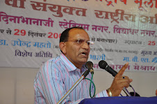
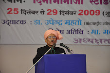
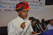
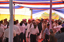
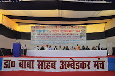


No comments:
Post a Comment